Area Overview for SO41 0PB
Photos of SO41 0PB
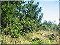
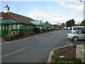
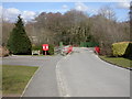
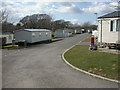
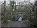
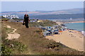
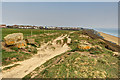
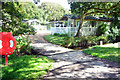
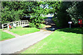
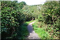
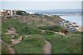
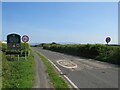
37 photos from this area
Area Information
Key information about the SO41 0PB including its size, population, and administrative classification.
- Area Type
- Postcode
- Area Size
- 27.6 hectares
- Population
- 1691
- Population Density
- 689 people/km²
House Prices in SO41 0PB
13
Properties
£1,737,903
Average Sold Price
£695,000
Lowest Price
£5,000,000
Highest Price
Showing 13 properties
| Address | Type | Beds | Baths | Last Sale Price | Last Sale Date | |
|---|---|---|---|---|---|---|
| Markway House, Blackbush Road, Milford On Sea, SO41 0PB | Retail | 5 | 3 | £1,300,000 | Feb 2022 | |
| Blackbush House, Blackbush Road, Milford On Sea, SO41 0PB | house | - | - | £5,000,000 | Jan 2021 | |
| Monkswood, Blackbush Road, Milford On Sea, SO41 0PB | house | - | - | £1,445,000 | Jul 2020 | |
| Sedges, Blackbush Road, Milford On Sea, SO41 0PB | Detached | 4 | - | £1,570,320 | Jan 2020 | |
| Bramblewood, Blackbush Road, Milford On Sea, SO41 0PB | Detached | 5 | 3 | £1,325,000 | Oct 2018 | |
| Daneswood, Blackbush Road, Milford On Sea, SO41 0PB | Detached | 4 | 3 | £830,000 | Jun 2012 | |
| Robinsway, Blackbush Road, Milford On Sea, SO41 0PB | Detached | 4 | 2 | £695,000 | Sep 2005 | |
| Woodlands, Blackbush Road, Milford On Sea, SO41 0PB | Detached | 3 | 3 | - | - | |
| Blackbush Cottage, Blackbush Road, Milford On Sea, SO41 0PB | Detached | 4 | 2 | - | - | |
| Amberwood House, Blackbush Road, Milford On Sea, SO41 0PB | Detached | 5 | - | - | - |
Page 1 of 2
Energy Efficiency in SO41 0PB
Amenities
Schools
| Rank | School | Type | Entry gender | Ages |
|---|
Explore more schools in this area
Go to Schools tabDemographics
Household Size
Two person
most common
Accommodation Type
Houses
most common
Tenure
83
majority
Ethnic Group
White
most common
Religion
N/A
most common
Household Composition
N/A
most common
Age
47
median
Elderly (65+ years)
most common
Household Deprivation
N/A
with no deprivation
NS-SEC
47
in Lower managerial occupations
Explore more demographic insights in this area
Go to Demographics tabPlanning
Planning Constraints
- Flood RiskPremium
- Ramsar Wetland SitesPremium
- Area of Outstanding Natural BeautyPremium
- Protected Nature ReservePremium
- Protected WoodlandPremium