Area Overview for SO41 0JJ
Photos of SO41 0JJ
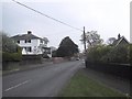

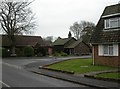
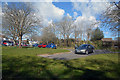


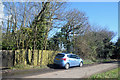
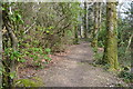
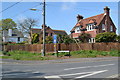
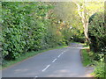
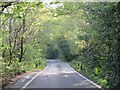
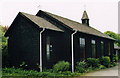
35 photos from this area
Area Information
Key information about the SO41 0JJ including its size, population, and administrative classification.
- Area Type
- Postcode
- Area Size
- 1.3 hectares
- Population
- 1999
- Population Density
- 432 people/km²
House Prices in SO41 0JJ
19
Properties
£344,182
Average Sold Price
£71,000
Lowest Price
£640,000
Highest Price
Showing 19 properties
| Address | Type | Beds | Baths | Last Sale Price | Last Sale Date | |
|---|---|---|---|---|---|---|
| Everton Cottage, 8 Old Christchurch Road, Everton, SO41 0JJ | Cottage | 4 | 1 | £590,000 | Dec 2020 | |
| Swan Cottage, 18 Old Christchurch Road, Everton, SO41 0JJ | Detached | - | - | £640,000 | Dec 2020 | |
| Selwood, 17 Old Christchurch Road, Everton, SO41 0JJ | Bungalow | 3 | 1 | £290,000 | Sep 2020 | |
| 7 Old Christchurch Road, Everton, SO41 0JJ | Bungalow | 3 | 2 | £300,000 | Oct 2017 | |
| Fernside, 15 Old Christchurch Road, Everton, SO41 0JJ | Semi-detached | 3 | - | £295,000 | Oct 2016 | |
| Sherleigh, 11 Old Christchurch Road, Everton, SO41 0JJ | house | - | - | £270,000 | Mar 2015 | |
| Woodley, 10 Old Christchurch Road, Everton, SO41 0JJ | Detached | 3 | 2 | £610,000 | Sep 2007 | |
| Wake Robin, 9 Old Christchurch Road, Everton, SO41 0JJ | Semi-detached | - | - | £248,000 | Jul 2006 | |
| Amber Forge, 27 Old Christchurch Road, Everton, SO41 0JJ | Land | - | - | £315,000 | Mar 2005 | |
| Old Mellow, 6 Old Christchurch Road, Everton, SO41 0JJ | Semi-detached | - | - | £157,000 | Aug 1997 |
Page 1 of 2
Energy Efficiency in SO41 0JJ
Amenities
Schools
| Rank | School | Type | Entry gender | Ages |
|---|
Explore more schools in this area
Go to Schools tabDemographics
Household Size
Two person
most common
Accommodation Type
Houses
most common
Tenure
90
majority
Ethnic Group
White
most common
Religion
N/A
most common
Household Composition
N/A
most common
Age
47
median
Elderly (65+ years)
most common
Household Deprivation
N/A
with no deprivation
NS-SEC
38
in Lower managerial occupations
Explore more demographic insights in this area
Go to Demographics tabPlanning
Planning Constraints
- Flood RiskPremium
- Ramsar Wetland SitesPremium
- Area of Outstanding Natural BeautyPremium
- Protected Nature ReservePremium
- Protected WoodlandPremium