Area Overview for SO40 9AP
Photos of SO40 9AP
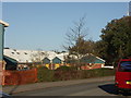
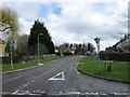
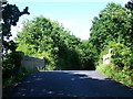
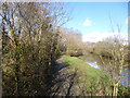
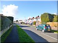
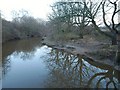
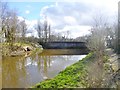
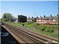
34 photos from this area
Area Information
Key information about the SO40 9AP including its size, population, and administrative classification.
- Area Type
- Postcode
- Area Size
- 6945 m²
- Population
- 1542
- Population Density
- 3049 people/km²
House Prices in SO40 9AP
15
Properties
£302,750
Average Sold Price
£82,000
Lowest Price
£530,000
Highest Price
Showing 15 properties
| Address | Type | Beds | Baths | Last Sale Price | Last Sale Date | |
|---|---|---|---|---|---|---|
| 26 Oakleigh Crescent, Totton, SO40 9AP | Bungalow | 3 | 1 | £465,000 | Sep 2025 | |
| 20 Oakleigh Crescent, Totton, SO40 9AP | Detached | 3 | 2 | £530,000 | Mar 2024 | |
| 24 Oakleigh Crescent, Totton, SO40 9AP | Bungalow | 3 | - | £460,000 | Oct 2021 | |
| 4 Oakleigh Crescent, Totton, SO40 9AP | Semi-detached | 3 | 1 | £249,000 | May 2015 | |
| 2 Oakleigh Crescent, Totton, SO40 9AP | Bungalow | 4 | - | £310,000 | Oct 2014 | |
| 22 Oakleigh Crescent, Totton, SO40 9AP | Bungalow | - | - | £229,000 | Mar 2010 | |
| 10 Oakleigh Crescent, Totton, SO40 9AP | Detached | - | - | £97,000 | Apr 1999 | |
| 6 Oakleigh Crescent, Totton, SO40 9AP | Semi-detached | - | - | £82,000 | Jun 1998 | |
| 12 Oakleigh Crescent, Totton, SO40 9AP | Detached | 3 | 1 | - | - | |
| Annexe, 2 Oakleigh Crescent, Totton, SO40 9AP | Flat | - | - | - | - |
Page 1 of 2
Energy Efficiency in SO40 9AP
Amenities
Schools
| Rank | School | Type | Entry gender | Ages |
|---|
Explore more schools in this area
Go to Schools tabDemographics
Household Size
Family (3-5 people)
most common
Accommodation Type
Houses
most common
Tenure
76
majority
Ethnic Group
White
most common
Religion
N/A
most common
Household Composition
N/A
most common
Age
47
median
Adults (30-64 years)
most common
Household Deprivation
N/A
with no deprivation
NS-SEC
29
in Lower managerial occupations
Explore more demographic insights in this area
Go to Demographics tabPlanning
Planning Constraints
- Flood RiskPremium
- Ramsar Wetland SitesPremium
- Area of Outstanding Natural BeautyPremium
- Protected Nature ReservePremium
- Protected WoodlandPremium