Area Overview for SO40 8WS
Photos of SO40 8WS
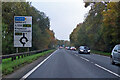
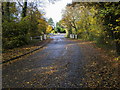
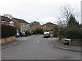

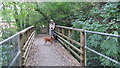
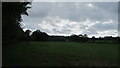
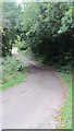
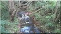
20 photos from this area
Area Information
Key information about the SO40 8WS including its size, population, and administrative classification.
- Area Type
- Postcode
- Area Size
- 1.6 hectares
- Population
- 1256
- Population Density
- 4683 people/km²
House Prices in SO40 8WS
37
Properties
£183,905
Average Sold Price
£47,500
Lowest Price
£362,500
Highest Price
Showing 37 properties
| Address | Type | Beds | Baths | Last Sale Price | Last Sale Date | |
|---|---|---|---|---|---|---|
| 23 Deridene Court, Totton, SO40 8WS | Terraced | 2 | 1 | £262,500 | Oct 2025 | |
| 11 Deridene Court, Totton, SO40 8WS | Terraced | 2 | 1 | £270,000 | Oct 2025 | |
| 24 Deridene Court, Totton, SO40 8WS | Detached | 3 | 1 | £362,500 | Sep 2025 | |
| 17 Deridene Court, Totton, SO40 8WS | Terraced | 2 | 1 | £291,000 | Jan 2025 | |
| 15 Deridene Court, Totton, SO40 8WS | Terraced | 2 | 1 | £273,000 | Oct 2024 | |
| 30 Deridene Court, Totton, SO40 8WS | house | - | - | £178,750 | Sep 2022 | |
| 21 Deridene Court, Totton, SO40 8WS | house | 2 | 1 | £235,000 | Sep 2021 | |
| 25 Deridene Court, Totton, SO40 8WS | Detached | 3 | 1 | £277,500 | Sep 2021 | |
| 8 Deridene Court, Totton, SO40 8WS | Terraced | 3 | 2 | £250,000 | Aug 2018 | |
| 34 Deridene Court, Totton, SO40 8WS | Semi-detached | 3 | 1 | £280,000 | May 2018 |
Page 1 of 4
Energy Efficiency in SO40 8WS
Amenities
Schools
| Rank | School | Type | Entry gender | Ages |
|---|
Explore more schools in this area
Go to Schools tabDemographics
Household Size
Two person
most common
Accommodation Type
Houses
most common
Tenure
81
majority
Ethnic Group
White
most common
Religion
N/A
most common
Household Composition
N/A
most common
Age
47
median
Adults (30-64 years)
most common
Household Deprivation
N/A
with no deprivation
NS-SEC
36
in Lower managerial occupations
Explore more demographic insights in this area
Go to Demographics tabPlanning
Planning Constraints
- Flood RiskPremium
- Ramsar Wetland SitesPremium
- Area of Outstanding Natural BeautyPremium
- Protected Nature ReservePremium
- Protected WoodlandPremium