Area Overview for SO40 4UN
Photos of SO40 4UN
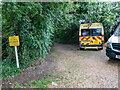
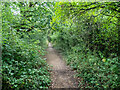
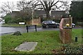
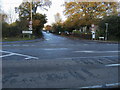
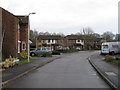
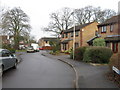
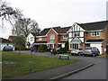
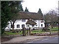
19 photos from this area
Area Information
Key information about the SO40 4UN including its size, population, and administrative classification.
- Area Type
- Postcode
- Area Size
- 1.1 km²
- Population
- 1749
- Population Density
- 582 people/km²
House Prices in SO40 4UN
40
Properties
£500,680
Average Sold Price
£210,000
Lowest Price
£1,130,000
Highest Price
Showing 40 properties
| Address | Type | Beds | Baths | Last Sale Price | Last Sale Date | |
|---|---|---|---|---|---|---|
| Homestead, Twiggs Lane, Marchwood, SO40 4UN | Bungalow | - | - | £495,000 | Mar 2023 | |
| Manor Farmhouse, Twiggs Lane, Marchwood, SO40 4UN | house | - | - | £700,000 | Jun 2022 | |
| Hazely, Twiggs Lane, Marchwood, SO40 4UN | Bungalow | 3 | 1 | £455,000 | Jun 2022 | |
| Swallows, Twiggs Lane, Marchwood, SO40 4UN | house | 4 | - | £1,130,000 | Jan 2022 | |
| Twiggs Farm Cottage, Twiggs Lane, Marchwood, SO40 4UN | Detached | 4 | 3 | £895,000 | Dec 2020 | |
| Candover, Twiggs Lane, Marchwood, SO40 4UN | Semi-detached | 3 | 1 | £427,500 | Jul 2020 | |
| Dene Cottage, Twiggs Lane, Marchwood, SO40 4UN | house | - | - | £580,000 | Nov 2019 | |
| Inglenook, Twiggs Lane, Marchwood, SO40 4UN | Detached | - | - | £527,000 | Jul 2018 | |
| Oakwoods, Twiggs Lane, Marchwood, SO40 4UN | Bungalow | 4 | 1 | £467,500 | Nov 2016 | |
| The Grange, Twiggs Lane, Marchwood, SO40 4UN | house | - | - | £402,500 | Mar 2016 |
Page 1 of 4
Energy Efficiency in SO40 4UN
Amenities
Schools
| Rank | School | Type | Entry gender | Ages |
|---|
Explore more schools in this area
Go to Schools tabDemographics
Household Size
Family (3-5 people)
most common
Accommodation Type
Houses
most common
Tenure
60
majority
Ethnic Group
White
most common
Religion
N/A
most common
Household Composition
N/A
most common
Age
47
median
Adults (30-64 years)
most common
Household Deprivation
N/A
with no deprivation
NS-SEC
37
in Lower managerial occupations
Explore more demographic insights in this area
Go to Demographics tabPlanning
Planning Constraints
- Flood RiskPremium
- Ramsar Wetland SitesPremium
- Area of Outstanding Natural BeautyPremium
- Protected Nature ReservePremium
- Protected WoodlandPremium