Area Overview for SO40 2RS
Photos of SO40 2RS

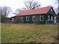
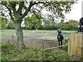

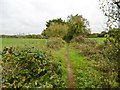
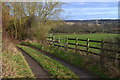
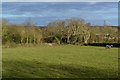
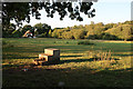


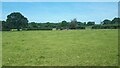

23 photos from this area
Area Information
Key information about the SO40 2RS including its size, population, and administrative classification.
- Area Type
- Postcode
- Area Size
- 30.6 hectares
- Population
- 1475
- Population Density
- 143 people/km²
House Prices in SO40 2RS
22
Properties
£694,217
Average Sold Price
£57,000
Lowest Price
£4,000,000
Highest Price
Showing 22 properties
| Address | Type | Beds | Baths | Last Sale Price | Last Sale Date | |
|---|---|---|---|---|---|---|
| Sandpiper, Pauletts Lane, Calmore, SO40 2RS | house | - | - | £710,000 | Oct 2023 | |
| Green Acres, Pauletts Lane, Calmore, SO40 2RS | Land | - | - | £4,000,000 | Feb 2023 | |
| Sunnyside, Pauletts Lane, Calmore, SO40 2RS | Bungalow | 3 | 1 | £450,000 | Dec 2021 | |
| Wayside, Pauletts Lane, Calmore, SO40 2RS | Land | - | - | £700,000 | Sep 2021 | |
| Holmwood Cottage, Pauletts Lane, Calmore, SO40 2RS | Detached | 2 | 1 | £408,000 | Aug 2021 | |
| Absolute Heaven, Trebarwith, Pauletts Lane, Calmore, SO40 2RS | Bungalow | 3 | - | £520,000 | Jan 2021 | |
| Villa Rosa, Pauletts Lane, Calmore, SO40 2RS | Bungalow | 2 | 1 | £360,000 | Feb 2020 | |
| Rose Bungalow, Pauletts Lane, Calmore, SO40 2RS | Bungalow | 3 | 2 | £487,500 | Sep 2019 | |
| Red Cottage, Pauletts Lane, Calmore, SO40 2RS | Detached | 3 | 1 | £276,100 | Nov 2003 | |
| Broad Oaks Cottage, Pauletts Lane, Calmore, SO40 2RS | Detached | - | - | £270,000 | Jul 1998 |
Page 1 of 3
Energy Efficiency in SO40 2RS
Amenities
Schools
| Rank | School | Type | Entry gender | Ages |
|---|
Explore more schools in this area
Go to Schools tabDemographics
Household Size
Two person
most common
Accommodation Type
Houses
most common
Tenure
87
majority
Ethnic Group
White
most common
Religion
N/A
most common
Household Composition
N/A
most common
Age
47
median
Adults (30-64 years)
most common
Household Deprivation
N/A
with no deprivation
NS-SEC
39
in Lower managerial occupations
Explore more demographic insights in this area
Go to Demographics tabPlanning
Planning Constraints
- Flood RiskPremium
- Ramsar Wetland SitesPremium
- Area of Outstanding Natural BeautyPremium
- Protected Nature ReservePremium
- Protected WoodlandPremium