Area Overview for SO40 2NX
Photos of SO40 2NX
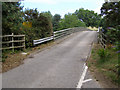

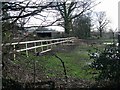
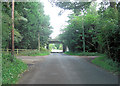
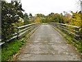
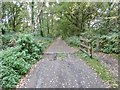
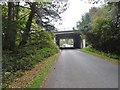


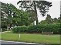
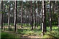

84 photos from this area
Area Information
Key information about the SO40 2NX including its size, population, and administrative classification.
- Area Type
- Postcode
- Area Size
- 11.5 hectares
- Population
- 1156
- Population Density
- 67 people/km²
House Prices in SO40 2NX
20
Properties
£447,167
Average Sold Price
£85,000
Lowest Price
£1,034,500
Highest Price
Showing 20 properties
| Address | Type | Beds | Baths | Last Sale Price | Last Sale Date | |
|---|---|---|---|---|---|---|
| Backways, Newbridge Road, Cadnam, SO40 2NX | Bungalow | 3 | 3 | £625,000 | Mar 2024 | |
| Old Pollards Moor, Newbridge Road, Cadnam, SO40 2NX | Detached | 5 | 3 | £1,034,500 | May 2023 | |
| Oakmoor, Newbridge Road, Cadnam, SO40 2NX | Land | - | - | £590,000 | Jan 2022 | |
| Hawthorne Cottage, Newbridge Road, Cadnam, SO40 2NX | Detached | 4 | 1 | £650,000 | Feb 2019 | |
| Ivy Cottage, Newbridge Road, Cadnam, SO40 2NX | Semi-detached | 3 | - | £360,000 | Jul 2018 | |
| Renfield, Newbridge Road, Cadnam, SO40 2NX | Detached | 4 | - | £550,000 | Oct 2015 | |
| The Gables, Newbridge Road, Cadnam, SO40 2NX | Detached | 4 | - | £465,000 | Sep 2014 | |
| The Kaws, Newbridge Road, Cadnam, SO40 2NX | Bungalow | 3 | 1 | £265,000 | Aug 2006 | |
| Blackstump, Newbridge Road, Cadnam, SO40 2NX | Detached | - | - | £295,000 | Jul 2006 | |
| Hollybank Cottage, Newbridge Road, Cadnam, SO40 2NX | Detached | - | - | £305,000 | Feb 2004 |
Page 1 of 2
Energy Efficiency in SO40 2NX
Amenities
Schools
| Rank | School | Type | Entry gender | Ages |
|---|
Explore more schools in this area
Go to Schools tabDemographics
Household Size
Two person
most common
Accommodation Type
Houses
most common
Tenure
89
majority
Ethnic Group
White
most common
Religion
N/A
most common
Household Composition
N/A
most common
Age
47
median
Adults (30-64 years)
most common
Household Deprivation
N/A
with no deprivation
NS-SEC
39
in Lower managerial occupations
Explore more demographic insights in this area
Go to Demographics tabPlanning
Planning Constraints
- Flood RiskPremium
- Ramsar Wetland SitesPremium
- Area of Outstanding Natural BeautyPremium
- Protected Nature ReservePremium
- Protected WoodlandPremium