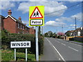
Area Overview for SO40 2NB
Photos of SO40 2NB
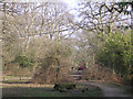
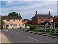
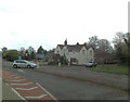
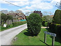
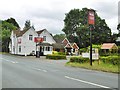


42 photos from this area
Area Information
Key information about the SO40 2NB including its size, population, and administrative classification.
- Area Type
- Postcode
- Area Size
- 3.1 hectares
- Population
- 1584
- Population Density
- 244 people/km²
House Prices in SO40 2NB
13
Properties
£414,158
Average Sold Price
£215,000
Lowest Price
£730,000
Highest Price
Showing 13 properties
| Address | Type | Beds | Baths | Last Sale Price | Last Sale Date | |
|---|---|---|---|---|---|---|
| Sidley, Southampton Road, Cadnam, SO40 2NB | Detached | 4 | 2 | £730,000 | Nov 2023 | |
| Four Post, Southampton Road, Cadnam, SO40 2NB | Bungalow | - | - | £525,000 | Feb 2023 | |
| Forest View, Southampton Road, Cadnam, SO40 2NB | Detached | - | - | £300,000 | Dec 2020 | |
| Nambour, Southampton Road, Cadnam, SO40 2NB | Bungalow | - | - | £285,000 | Jul 2012 | |
| Poynings, Southampton Road, Cadnam, SO40 2NB | Detached | 4 | 3 | £429,950 | Feb 2012 | |
| Hazelmere, Southampton Road, Cadnam, SO40 2NB | Detached | 4 | 2 | £215,000 | May 2002 | |
| Little Orchard, Southampton Road, Cadnam, SO40 2NB | Bungalow | 4 | - | - | - | |
| Southern Aquatics And Reptiles, Cadnam Garden Centre, Southampton Road, Cadnam, SO40 2NB | shop | - | - | - | - | |
| Conservatory Village, Cadnam Garden Centre, Southampton Road, Cadnam, SO40 2NB | retail_financial | - | - | - | - | |
| Le Jardin Cafe, Cadnam Garden Centre, Southampton Road, Cadnam, SO40 2NB | Restaurant | - | - | - | - |
Page 1 of 2
Energy Efficiency in SO40 2NB
Amenities
Schools
| Rank | School | Type | Entry gender | Ages |
|---|
Explore more schools in this area
Go to Schools tabDemographics
Household Size
Two person
most common
Accommodation Type
Houses
most common
Tenure
88
majority
Ethnic Group
White
most common
Religion
N/A
most common
Household Composition
N/A
most common
Age
47
median
Adults (30-64 years)
most common
Household Deprivation
N/A
with no deprivation
NS-SEC
43
in Lower managerial occupations
Explore more demographic insights in this area
Go to Demographics tabPlanning
Planning Constraints
- Flood RiskPremium
- Ramsar Wetland SitesPremium
- Area of Outstanding Natural BeautyPremium
- Protected Nature ReservePremium
- Protected WoodlandPremium