Area Overview for SO32 3QQ
Photos of SO32 3QQ
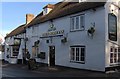
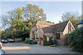
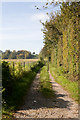
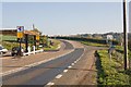
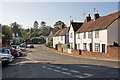
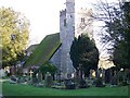
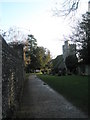
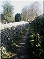
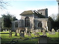
100 photos from this area
Area Information
Key information about the SO32 3QQ including its size, population, and administrative classification.
- Area Type
- Postcode
- Area Size
- 35.9 hectares
- Population
- 2105
- Population Density
- 52 people/km²
House Prices in SO32 3QQ
47
Properties
£305,808
Average Sold Price
£147,000
Lowest Price
£510,000
Highest Price
Showing 47 properties
| Address | Type | Beds | Baths | Last Sale Price | Last Sale Date | |
|---|---|---|---|---|---|---|
| 32 The Park, Droxford, SO32 3QQ | Semi-detached | 3 | 1 | £469,500 | Apr 2024 | |
| 13 The Park, Droxford, SO32 3QQ | Semi-detached | 4 | 1 | £510,000 | Apr 2024 | |
| 31 The Park, Droxford, SO32 3QQ | house | - | - | £485,000 | Oct 2022 | |
| 9B The Park, Droxford, SO32 3QQ | Flat | - | - | £173,500 | Mar 2021 | |
| 9A The Park, Droxford, SO32 3QQ | Flat | 2 | 1 | £190,000 | Aug 2019 | |
| 20 The Park, Droxford, SO32 3QQ | house | - | - | £395,000 | Dec 2018 | |
| 9 The Park, Droxford, SO32 3QQ | Terraced | 3 | 1 | £283,500 | May 2017 | |
| 29 The Park, Droxford, SO32 3QQ | house | - | - | £229,000 | Aug 2014 | |
| 24 The Park, Droxford, SO32 3QQ | Semi-detached | 4 | 2 | £245,000 | Sep 2013 | |
| 4 The Park, Droxford, SO32 3QQ | Semi-detached | 3 | 2 | £278,000 | Dec 2010 |
Page 1 of 5
Energy Efficiency in SO32 3QQ
Amenities
Schools
| Rank | School | Type | Entry gender | Ages |
|---|
Explore more schools in this area
Go to Schools tabDemographics
Household Size
Two person
most common
Accommodation Type
Houses
most common
Tenure
74
majority
Ethnic Group
White
most common
Religion
N/A
most common
Household Composition
N/A
most common
Age
47
median
Adults (30-64 years)
most common
Household Deprivation
N/A
with no deprivation
NS-SEC
49
in Lower managerial occupations
Explore more demographic insights in this area
Go to Demographics tabPlanning
Planning Constraints
- Flood RiskPremium
- Ramsar Wetland SitesPremium
- Area of Outstanding Natural BeautyPremium
- Protected Nature ReservePremium
- Protected WoodlandPremium