Area Overview for SO32 3PY
Photos of SO32 3PY
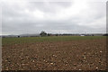
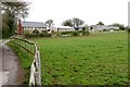
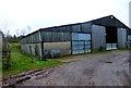
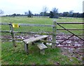
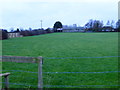
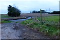
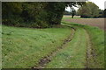
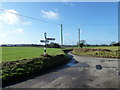
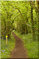
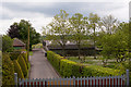
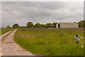
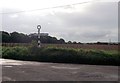
18 photos from this area
Area Information
Key information about the SO32 3PY including its size, population, and administrative classification.
- Area Type
- Postcode
- Area Size
- 23.5 hectares
- Population
- 1257
- Population Density
- 85 people/km²
House Prices in SO32 3PY
24
Properties
£663,750
Average Sold Price
£380,000
Lowest Price
£1,030,000
Highest Price
Showing 24 properties
| Address | Type | Beds | Baths | Last Sale Price | Last Sale Date | |
|---|---|---|---|---|---|---|
| Greenbank Cottage, Webbs Green, Soberton, SO32 3PY | Detached | 4 | - | £740,000 | Jun 2021 | |
| Cherry Tree Farm, Hambledon Lane, Soberton, SO32 3PY | house | - | - | £1,000,000 | Mar 2021 | |
| Half Acre Cottage, Webbs Green, Soberton, SO32 3PY | Semi-detached | - | - | £835,000 | Oct 2020 | |
| Cherrywood Lodge, Webbs Green, Soberton, SO32 3PY | Detached | 2 | 1 | £515,000 | Jan 2019 | |
| Falcon Field, Webbs Green, Soberton, SO32 3PY | house | 3 | - | £550,000 | Jun 2013 | |
| Rivendell, Webbs Green, Soberton, SO32 3PY | Detached | 4 | - | £750,000 | Apr 2012 | |
| The Barn, Webbs Green, Soberton, SO32 3PY | Detached | - | - | £380,000 | Jul 2008 | |
| Webbs Green House, Webbs Green, Soberton, SO32 3PY | house | - | - | £1,030,000 | Jul 2007 | |
| Lovesgrove, Webbs Green, Soberton, SO32 3PY | Detached | - | - | £420,000 | Dec 2006 | |
| Forge Cottage, Webbs Green, Soberton, SO32 3PY | Detached | - | - | £660,000 | Sep 2006 |
Page 1 of 3
Energy Efficiency in SO32 3PY
Amenities
Schools
| Rank | School | Type | Entry gender | Ages |
|---|
Explore more schools in this area
Go to Schools tabDemographics
Household Size
Two person
most common
Accommodation Type
Houses
most common
Tenure
88
majority
Ethnic Group
White
most common
Religion
N/A
most common
Household Composition
N/A
most common
Age
47
median
Adults (30-64 years)
most common
Household Deprivation
N/A
with no deprivation
NS-SEC
49
in Lower managerial occupations
Explore more demographic insights in this area
Go to Demographics tabPlanning
Planning Constraints
- Flood RiskPremium
- Ramsar Wetland SitesPremium
- Area of Outstanding Natural BeautyPremium
- Protected Nature ReservePremium
- Protected WoodlandPremium