Area Overview for SO32 3PA
Photos of SO32 3PA
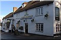
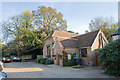

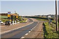
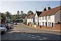
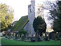
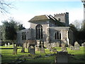
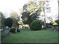
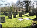
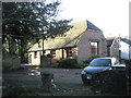
102 photos from this area
Area Information
Key information about the SO32 3PA including its size, population, and administrative classification.
- Area Type
- Postcode
- Area Size
- 2.2 hectares
- Population
- 2105
- Population Density
- 52 people/km²
House Prices in SO32 3PA
36
Properties
£584,125
Average Sold Price
£100,000
Lowest Price
£2,150,000
Highest Price
Showing 36 properties
| Address | Type | Beds | Baths | Last Sale Price | Last Sale Date | |
|---|---|---|---|---|---|---|
| The Old Post House, High Street, Droxford, SO32 3PA | Detached | 4 | - | £825,000 | Aug 2024 | |
| Bakers Lodge, High Street, Droxford, SO32 3PA | Bungalow | - | - | £432,500 | Nov 2021 | |
| Brier House, High Street, Droxford, SO32 3PA | Detached | 4 | 1 | £710,000 | Sep 2021 | |
| Meon House, High Street, Droxford, SO32 3PA | Detached | 3 | 1 | £992,500 | Jun 2021 | |
| Sarum House, High Street, Droxford, SO32 3PA | house | - | - | £740,000 | Mar 2021 | |
| Manor House, High Street, Droxford, SO32 3PA | Detached | - | - | £2,150,000 | Feb 2021 | |
| Clematis Cottage, High Street, Droxford, SO32 3PA | house | - | - | £433,000 | Jul 2018 | |
| 1 High Street, Droxford, SO32 3PA | Terraced | 2 | 1 | £260,000 | Nov 2017 | |
| Yew Tree Cottage, High Street, Droxford, SO32 3PA | Detached | 4 | 2 | £585,000 | Jul 2016 | |
| Acorn, High Street, Droxford, SO32 3PA | Bungalow | 2 | 1 | £215,000 | Jan 2016 |
Page 1 of 4
Energy Efficiency in SO32 3PA
Amenities
Schools
| Rank | School | Type | Entry gender | Ages |
|---|
Explore more schools in this area
Go to Schools tabDemographics
Household Size
Two person
most common
Accommodation Type
Houses
most common
Tenure
74
majority
Ethnic Group
White
most common
Religion
N/A
most common
Household Composition
N/A
most common
Age
47
median
Adults (30-64 years)
most common
Household Deprivation
N/A
with no deprivation
NS-SEC
49
in Lower managerial occupations
Explore more demographic insights in this area
Go to Demographics tabPlanning
Planning Constraints
- Flood RiskPremium
- Ramsar Wetland SitesPremium
- Area of Outstanding Natural BeautyPremium
- Protected Nature ReservePremium
- Protected WoodlandPremium