Area Overview for SO32 2PB
Photos of SO32 2PB
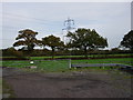
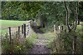
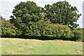
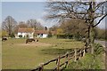

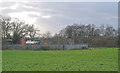

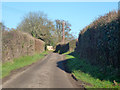
8 photos from this area
Area Information
Key information about the SO32 2PB including its size, population, and administrative classification.
- Area Type
- Postcode
- Area Size
- 31.6 hectares
- Population
- 1694
- Population Density
- 219 people/km²
House Prices in SO32 2PB
53
Properties
£469,015
Average Sold Price
£88,000
Lowest Price
£1,250,000
Highest Price
Showing 53 properties
| Address | Type | Beds | Baths | Last Sale Price | Last Sale Date | |
|---|---|---|---|---|---|---|
| Crossways, Lower Chase Road, Swanmore, SO32 2PB | Bungalow | 3 | 2 | £780,000 | Mar 2025 | |
| Moss Bank, Lower Chase Road, Swanmore, SO32 2PB | Bungalow | 2 | - | £375,000 | Jun 2024 | |
| Wellside, Lower Chase Road, Swanmore, SO32 2PB | Bungalow | 3 | 1 | £440,000 | Mar 2024 | |
| Ivydene, Lower Chase Road, Swanmore, SO32 2PB | house | 4 | - | £767,500 | Sep 2022 | |
| Eastways, Lower Chase Road, Swanmore, SO32 2PB | house | - | - | £625,000 | May 2021 | |
| Clover View, Lower Chase Road, Swanmore, SO32 2PB | Detached | 4 | - | £662,500 | Apr 2021 | |
| Appletree Cottage, Lower Chase Road, Swanmore, SO32 2PB | Detached | 4 | 2 | £600,000 | Jun 2020 | |
| Millstone Cottage, Lower Chase Road, Swanmore, SO32 2PB | Detached | 4 | 2 | £635,000 | Jan 2020 | |
| Ivy Cottage, Lower Chase Road, Swanmore, SO32 2PB | Chalet | 4 | 1 | £489,950 | Apr 2018 | |
| Fields Farm, Lower Chase Road, Swanmore, SO32 2PB | Farm | 4 | 1 | £1,250,000 | Jan 2017 |
Page 1 of 6
Energy Efficiency in SO32 2PB
Amenities
Schools
| Rank | School | Type | Entry gender | Ages |
|---|
Explore more schools in this area
Go to Schools tabDemographics
Household Size
Two person
most common
Accommodation Type
Houses
most common
Tenure
75
majority
Ethnic Group
White
most common
Religion
N/A
most common
Household Composition
N/A
most common
Age
47
median
Adults (30-64 years)
most common
Household Deprivation
N/A
with no deprivation
NS-SEC
46
in Lower managerial occupations
Explore more demographic insights in this area
Go to Demographics tabPlanning
Planning Constraints
- Flood RiskPremium
- Ramsar Wetland SitesPremium
- Area of Outstanding Natural BeautyPremium
- Protected Nature ReservePremium
- Protected WoodlandPremium