Area Overview for SO31 6UL
Photos of SO31 6UL
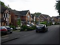
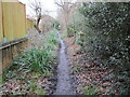
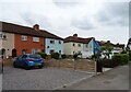
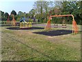
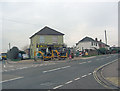
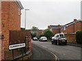

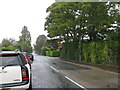
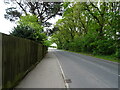
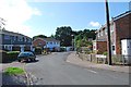
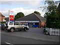
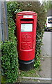
14 photos from this area
Area Information
Key information about the SO31 6UL including its size, population, and administrative classification.
- Area Type
- Postcode
- Area Size
- 6531 m²
- Population
- 1364
- Population Density
- 4200 people/km²
House Prices in SO31 6UL
15
Properties
£423,485
Average Sold Price
£238,000
Lowest Price
£522,000
Highest Price
Showing 15 properties
| Address | Type | Beds | Baths | Last Sale Price | Last Sale Date | |
|---|---|---|---|---|---|---|
| 24 Glendale, Locks Heath, Southampton, SO31 6UL | Detached | 4 | 2 | £515,000 | Sep 2025 | |
| 8 Glendale, Locks Heath, Southampton, SO31 6UL | Detached | 4 | 3 | £410,833 | Feb 2023 | |
| 20 Glendale, Locks Heath, Southampton, SO31 6UL | house | - | - | £490,000 | Feb 2022 | |
| 26 Glendale, Locks Heath, Southampton, SO31 6UL | Detached | 4 | 2 | £522,000 | Apr 2021 | |
| 16 Glendale, Locks Heath, Southampton, SO31 6UL | house | - | - | £410,000 | Dec 2020 | |
| 2 Glendale, Locks Heath, Southampton, SO31 6UL | house | - | - | £410,000 | Nov 2020 | |
| 12 Glendale, Locks Heath, Southampton, SO31 6UL | Detached | 4 | 2 | £430,000 | Sep 2020 | |
| 22 Glendale, Locks Heath, Southampton, SO31 6UL | Detached | 4 | 2 | £490,000 | Jul 2020 | |
| 28 Glendale, Locks Heath, Southampton, SO31 6UL | Detached | 4 | - | £482,500 | Aug 2018 | |
| 10 Glendale, Locks Heath, Southampton, SO31 6UL | house | 4 | - | £260,000 | Aug 2012 |
Page 1 of 2
Energy Efficiency in SO31 6UL
Amenities
Schools
| Rank | School | Type | Entry gender | Ages |
|---|
Explore more schools in this area
Go to Schools tabDemographics
Household Size
Two person
most common
Accommodation Type
Houses
most common
Tenure
95
majority
Ethnic Group
White
most common
Religion
N/A
most common
Household Composition
N/A
most common
Age
47
median
Adults (30-64 years)
most common
Household Deprivation
N/A
with no deprivation
NS-SEC
51
in Lower managerial occupations
Explore more demographic insights in this area
Go to Demographics tabPlanning
Planning Constraints
- Flood RiskPremium
- Ramsar Wetland SitesPremium
- Area of Outstanding Natural BeautyPremium
- Protected Nature ReservePremium
- Protected WoodlandPremium