Area Overview for SO31 5AP
Photos of SO31 5AP

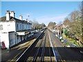
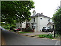
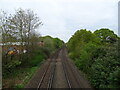
36 photos from this area
Area Information
Key information about the SO31 5AP including its size, population, and administrative classification.
- Area Type
- Postcode
- Area Size
- 3.8 hectares
- Population
- 1595
- Population Density
- 4773 people/km²
House Prices in SO31 5AP
13
Properties
£471,600
Average Sold Price
£360,000
Lowest Price
£560,000
Highest Price
Showing 13 properties
| Address | Type | Beds | Baths | Last Sale Price | Last Sale Date | |
|---|---|---|---|---|---|---|
| Birchcroft, Gashouse Hill, Netley Abbey, SO31 5AP | Detached | 4 | - | £560,000 | Nov 2020 | |
| Ashbourne, Gashouse Hill, Netley Abbey, SO31 5AP | Detached | 4 | 2 | £490,000 | Oct 2020 | |
| Maplecroft, Gashouse Hill, Netley Abbey, SO31 5AP | Detached | 4 | 3 | £513,000 | Jul 2018 | |
| Four Seasons, Gashouse Hill, Netley Abbey, SO31 5AP | Bungalow | 4 | - | £360,000 | Jul 2015 | |
| Cherrycroft, Gashouse Hill, Netley Abbey, SO31 5AP | Detached | 4 | - | £435,000 | Oct 2014 | |
| Hollybush House, Gashouse Hill, Netley Abbey, SO31 5AP | Detached | 4 | 2 | - | - | |
| 2, Victoria Glade, Gashouse Hill, Netley Abbey, SO31 5AP | Detached | 4 | 2 | - | - | |
| Loxwood, Gashouse Hill, Netley Abbey, SO31 5AP | Detached | 4 | 3 | - | - | |
| 1, Victoria Glade, Gashouse Hill, Netley Abbey, SO31 5AP | house | 4 | - | - | - | |
| 3, Victoria Glade, Gashouse Hill, Netley Abbey, SO31 5AP | house | - | - | - | - |
Page 1 of 2
Energy Efficiency in SO31 5AP
Amenities
Schools
| Rank | School | Type | Entry gender | Ages |
|---|
Explore more schools in this area
Go to Schools tabDemographics
Household Size
Two person
most common
Accommodation Type
Houses
most common
Tenure
75
majority
Ethnic Group
White
most common
Religion
N/A
most common
Household Composition
N/A
most common
Age
47
median
Adults (30-64 years)
most common
Household Deprivation
N/A
with no deprivation
NS-SEC
38
in Lower managerial occupations
Explore more demographic insights in this area
Go to Demographics tabPlanning
Planning Constraints
- Flood RiskPremium
- Ramsar Wetland SitesPremium
- Area of Outstanding Natural BeautyPremium
- Protected Nature ReservePremium
- Protected WoodlandPremium