Area Overview for SO31 1DQ
Photos of SO31 1DQ
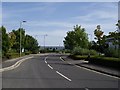

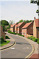
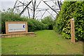


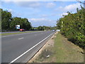

28 photos from this area
Area Information
Key information about the SO31 1DQ including its size, population, and administrative classification.
- Area Type
- Postcode
- Area Size
- 1.4 hectares
- Population
- 2287
- Population Density
- 2237 people/km²
House Prices in SO31 1DQ
14
Properties
£321,992
Average Sold Price
£240,000
Lowest Price
£595,000
Highest Price
Showing 14 properties
| Address | Type | Beds | Baths | Last Sale Price | Last Sale Date | |
|---|---|---|---|---|---|---|
| 29 Red Oaks Drive, Park Gate, Southampton, SO31 1DQ | Detached | 4 | 2 | £595,000 | Dec 2022 | |
| 31 Red Oaks Drive, Park Gate, Southampton, SO31 1DQ | Detached | 4 | 3 | £436,500 | Dec 2020 | |
| 51 Red Oaks Drive, Park Gate, Southampton, SO31 1DQ | Semi-detached | 3 | 2 | £375,000 | Dec 2020 | |
| 43 Red Oaks Drive, Park Gate, Southampton, SO31 1DQ | Semi-detached | 3 | 3 | £345,000 | May 2017 | |
| 35 Red Oaks Drive, Park Gate, Southampton, SO31 1DQ | house | 3 | - | £244,000 | Oct 2013 | |
| 27 Red Oaks Drive, Park Gate, Southampton, SO31 1DQ | Detached | 4 | 2 | £295,000 | Oct 2011 | |
| 49 Red Oaks Drive, Park Gate, Southampton, SO31 1DQ | Terraced | 3 | 2 | £245,500 | Apr 2011 | |
| 39 Red Oaks Drive, Park Gate, Southampton, SO31 1DQ | house | - | - | £240,000 | Aug 2009 | |
| 37 Red Oaks Drive, Park Gate, Southampton, SO31 1DQ | house | - | - | £250,000 | Mar 2008 | |
| 25 Red Oaks Drive, Park Gate, Southampton, SO31 1DQ | Detached | - | - | £344,950 | Dec 2007 |
Page 1 of 2
Energy Efficiency in SO31 1DQ
Amenities
Schools
| Rank | School | Type | Entry gender | Ages |
|---|
Explore more schools in this area
Go to Schools tabDemographics
Household Size
One person
most common
Accommodation Type
Houses
most common
Tenure
63
majority
Ethnic Group
White
most common
Religion
N/A
most common
Household Composition
N/A
most common
Age
47
median
Adults (30-64 years)
most common
Household Deprivation
N/A
with no deprivation
NS-SEC
41
in Lower managerial occupations
Explore more demographic insights in this area
Go to Demographics tabPlanning
Planning Constraints
- Flood RiskPremium
- Ramsar Wetland SitesPremium
- Area of Outstanding Natural BeautyPremium
- Protected Nature ReservePremium
- Protected WoodlandPremium