Area Overview for SO30 4AX
Photos of SO30 4AX


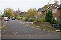
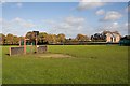


31 photos from this area
Area Information
Key information about the SO30 4AX including its size, population, and administrative classification.
- Area Type
- Postcode
- Area Size
- 1.2 hectares
- Population
- 1585
- Population Density
- 2481 people/km²
House Prices in SO30 4AX
19
Properties
£395,708
Average Sold Price
£58,500
Lowest Price
£765,000
Highest Price
Showing 19 properties
| Address | Type | Beds | Baths | Last Sale Price | Last Sale Date | |
|---|---|---|---|---|---|---|
| Songari, Reservoir Lane, Hedge End, SO30 4AX | Detached | 3 | 1 | £370,000 | Feb 2022 | |
| Reservoir House, Reservoir Lane, Hedge End, SO30 4AX | Detached | 4 | 2 | £670,000 | Dec 2020 | |
| Everon, Reservoir Lane, Hedge End, SO30 4AX | house | 5 | - | £765,000 | Dec 2020 | |
| Walton Flints, Reservoir Lane, Hedge End, SO30 4AX | house | - | - | £680,000 | Jun 2020 | |
| Oakridge House, Reservoir Lane, Hedge End, SO30 4AX | house | - | - | £470,000 | Apr 2017 | |
| Elton Lodge, Reservoir Lane, Hedge End, SO30 4AX | house | - | - | £470,000 | Nov 2013 | |
| North Hill Bungalow, Reservoir Lane, Hedge End, SO30 4AX | Bungalow | 5 | - | £445,000 | Jun 2011 | |
| 30 Reservoir Lane, Hedge End, SO30 4AX | house | - | - | £310,000 | Mar 2010 | |
| 29 Reservoir Lane, Hedge End, SO30 4AX | Detached | 3 | - | £275,000 | Dec 2005 | |
| Longford, Reservoir Lane, Hedge End, SO30 4AX | Bungalow | - | - | £83,000 | Jun 1998 |
Page 1 of 2
Energy Efficiency in SO30 4AX
Amenities
Schools
| Rank | School | Type | Entry gender | Ages |
|---|
Explore more schools in this area
Go to Schools tabDemographics
Household Size
Two person
most common
Accommodation Type
Houses
most common
Tenure
87
majority
Ethnic Group
White
most common
Religion
N/A
most common
Household Composition
N/A
most common
Age
47
median
Adults (30-64 years)
most common
Household Deprivation
N/A
with no deprivation
NS-SEC
40
in Lower managerial occupations
Explore more demographic insights in this area
Go to Demographics tabPlanning
Planning Constraints
- Flood RiskPremium
- Ramsar Wetland SitesPremium
- Area of Outstanding Natural BeautyPremium
- Protected Nature ReservePremium
- Protected WoodlandPremium