Area Overview for SO30 3AG
Photos of SO30 3AG


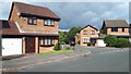
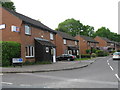
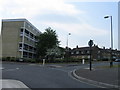

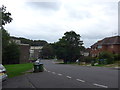


17 photos from this area
Area Information
Key information about the SO30 3AG including its size, population, and administrative classification.
- Area Type
- Postcode
- Area Size
- 2.5 hectares
- Population
- 1453
- Population Density
- 5338 people/km²
House Prices in SO30 3AG
46
Properties
£261,902
Average Sold Price
£50,000
Lowest Price
£575,000
Highest Price
Showing 46 properties
| Address | Type | Beds | Baths | Last Sale Price | Last Sale Date | |
|---|---|---|---|---|---|---|
| 15 Swaythling Road, West End, SO30 3AG | Flat | - | - | £182,500 | Aug 2025 | |
| 25A Swaythling Road, West End, SO30 3AG | Detached | 2 | 2 | £575,000 | Feb 2025 | |
| 25 Swaythling Road, West End, SO30 3AG | Semi-detached | 2 | 1 | £372,500 | Jan 2023 | |
| 39 Swaythling Road, West End, SO30 3AG | Retail | 4 | 1 | £530,000 | Mar 2022 | |
| 71 Swaythling Road, West End, SO30 3AG | house | - | - | £275,000 | Feb 2022 | |
| 23 Swaythling Road, West End, SO30 3AG | Detached | 5 | 3 | £540,000 | Jan 2022 | |
| 57 Swaythling Road, West End, SO30 3AG | Semi-detached | 3 | - | £360,000 | Dec 2020 | |
| 87 Swaythling Road, West End, SO30 3AG | Semi-detached | 4 | 4 | £267,000 | Jul 2020 | |
| 65 Swaythling Road, West End, SO30 3AG | Semi-detached | 3 | 2 | £308,000 | Jun 2019 | |
| 89A Swaythling Road, West End, SO30 3AG | Detached | 4 | 3 | £440,000 | Mar 2019 |
Page 1 of 5
Energy Efficiency in SO30 3AG
Amenities
Schools
| Rank | School | Type | Entry gender | Ages |
|---|
Explore more schools in this area
Go to Schools tabDemographics
Household Size
One person
most common
Accommodation Type
Houses
most common
Tenure
62
majority
Ethnic Group
White
most common
Religion
N/A
most common
Household Composition
N/A
most common
Age
47
median
Adults (30-64 years)
most common
Household Deprivation
N/A
with no deprivation
NS-SEC
33
in Lower managerial occupations
Explore more demographic insights in this area
Go to Demographics tabPlanning
Planning Constraints
- Flood RiskPremium
- Ramsar Wetland SitesPremium
- Area of Outstanding Natural BeautyPremium
- Protected Nature ReservePremium
- Protected WoodlandPremium