Area Overview for SO30 0LJ
Photos of SO30 0LJ
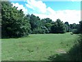
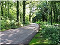
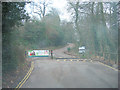
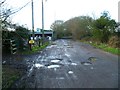
33 photos from this area
Area Information
Key information about the SO30 0LJ including its size, population, and administrative classification.
- Area Type
- Postcode
- Area Size
- 1.4 hectares
- Population
- 1982
- Population Density
- 1581 people/km²
House Prices in SO30 0LJ
29
Properties
£254,706
Average Sold Price
£119,500
Lowest Price
£395,000
Highest Price
Showing 29 properties
| Address | Type | Beds | Baths | Last Sale Price | Last Sale Date | |
|---|---|---|---|---|---|---|
| 38 Stockholm Drive, Hedge End, SO30 0LJ | Retail | 3 | 1 | £370,000 | Oct 2022 | |
| 10 Stockholm Drive, Hedge End, SO30 0LJ | house | - | - | £380,000 | Jun 2021 | |
| 20 Stockholm Drive, Hedge End, SO30 0LJ | house | 4 | 1 | £395,000 | Nov 2019 | |
| 26 Stockholm Drive, Hedge End, SO30 0LJ | house | - | - | £348,000 | Aug 2018 | |
| 14 Stockholm Drive, Hedge End, SO30 0LJ | Detached | 3 | 1 | £334,000 | Nov 2017 | |
| 4 Stockholm Drive, Hedge End, SO30 0LJ | house | 3 | - | £265,000 | Jul 2014 | |
| 22 Stockholm Drive, Hedge End, SO30 0LJ | house | 3 | - | £275,000 | Aug 2012 | |
| 7 Stockholm Drive, Hedge End, SO30 0LJ | house | 3 | - | £207,500 | Jun 2011 | |
| 34 Stockholm Drive, Hedge End, SO30 0LJ | Semi-detached | - | - | £225,000 | Apr 2010 | |
| 5 Stockholm Drive, Hedge End, SO30 0LJ | Semi-detached | 3 | 2 | £192,000 | Apr 2009 |
Page 1 of 3
Energy Efficiency in SO30 0LJ
Amenities
Schools
| Rank | School | Type | Entry gender | Ages |
|---|
Explore more schools in this area
Go to Schools tabDemographics
Household Size
Family (3-5 people)
most common
Accommodation Type
Houses
most common
Tenure
84
majority
Ethnic Group
White
most common
Religion
N/A
most common
Household Composition
N/A
most common
Age
47
median
Adults (30-64 years)
most common
Household Deprivation
N/A
with no deprivation
NS-SEC
38
in Lower managerial occupations
Explore more demographic insights in this area
Go to Demographics tabPlanning
Planning Constraints
- Flood RiskPremium
- Ramsar Wetland SitesPremium
- Area of Outstanding Natural BeautyPremium
- Protected Nature ReservePremium
- Protected WoodlandPremium