Area Overview for SO30 0HN
Photos of SO30 0HN
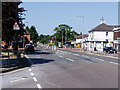

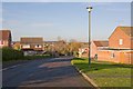

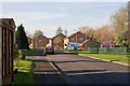
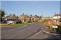
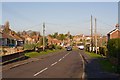

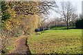
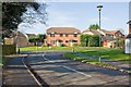
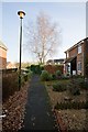
47 photos from this area
Area Information
Key information about the SO30 0HN including its size, population, and administrative classification.
- Area Type
- Postcode
- Area Size
- 2.1 hectares
- Population
- 1500
- Population Density
- 4825 people/km²
House Prices in SO30 0HN
50
Properties
£275,217
Average Sold Price
£65,500
Lowest Price
£475,000
Highest Price
Showing 50 properties
| Address | Type | Beds | Baths | Last Sale Price | Last Sale Date | |
|---|---|---|---|---|---|---|
| 31 Westbury Court, Hedge End, SO30 0HN | Semi-detached | 2 | 1 | £329,500 | May 2024 | |
| 10 Westbury Court, Hedge End, SO30 0HN | Detached | 2 | 2 | £320,000 | May 2023 | |
| 12A Westbury Court, Hedge End, SO30 0HN | Detached | 4 | 3 | £475,000 | May 2023 | |
| 27 Westbury Court, Hedge End, SO30 0HN | Semi-detached | 2 | 1 | £322,500 | Mar 2023 | |
| 34 Westbury Court, Hedge End, SO30 0HN | house | - | - | £250,000 | Jun 2022 | |
| 37 Westbury Court, Hedge End, SO30 0HN | house | - | - | £285,000 | Dec 2021 | |
| 4 Westbury Court, Hedge End, SO30 0HN | Bungalow | - | - | £315,000 | May 2021 | |
| Halladale, 7 Westbury Court, Hedge End, SO30 0HN | Bungalow | 3 | 1 | £325,000 | Mar 2021 | |
| 29 Westbury Court, Hedge End, SO30 0HN | house | - | - | £315,000 | Dec 2020 | |
| 32 Westbury Court, Hedge End, SO30 0HN | Semi-detached | 4 | 1 | £325,000 | Oct 2020 |
Page 1 of 5
Energy Efficiency in SO30 0HN
Amenities
Schools
| Rank | School | Type | Entry gender | Ages |
|---|
Explore more schools in this area
Go to Schools tabDemographics
Household Size
Two person
most common
Accommodation Type
Houses
most common
Tenure
93
majority
Ethnic Group
White
most common
Religion
N/A
most common
Household Composition
N/A
most common
Age
47
median
Adults (30-64 years)
most common
Household Deprivation
N/A
with no deprivation
NS-SEC
37
in Lower managerial occupations
Explore more demographic insights in this area
Go to Demographics tabPlanning
Planning Constraints
- Flood RiskPremium
- Ramsar Wetland SitesPremium
- Area of Outstanding Natural BeautyPremium
- Protected Nature ReservePremium
- Protected WoodlandPremium