Area Overview for SO30 0DP
Photos of SO30 0DP
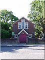
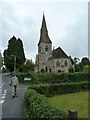
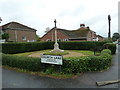
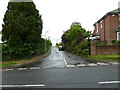
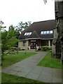

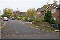
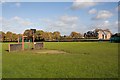
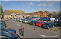


31 photos from this area
Area Information
Key information about the SO30 0DP including its size, population, and administrative classification.
- Area Type
- Postcode
- Area Size
- 9105 m²
- Population
- 1982
- Population Density
- 1581 people/km²
House Prices in SO30 0DP
18
Properties
£279,369
Average Sold Price
£98,950
Lowest Price
£600,000
Highest Price
Showing 18 properties
| Address | Type | Beds | Baths | Last Sale Price | Last Sale Date | |
|---|---|---|---|---|---|---|
| 2B Alexandra Road, Hedge End, SO30 0DP | Semi-detached | 3 | 1 | £355,000 | Sep 2022 | |
| 14 Alexandra Road, Hedge End, SO30 0DP | house | - | - | £600,000 | Aug 2022 | |
| 12 Alexandra Road, Hedge End, SO30 0DP | Detached | 4 | - | £400,000 | Dec 2021 | |
| 8 Alexandra Road, Hedge End, SO30 0DP | house | 3 | 1 | £365,000 | Oct 2020 | |
| 20 Alexandra Road, Hedge End, SO30 0DP | Semi-detached | 3 | 1 | £360,000 | Jan 2020 | |
| Church View Cottage, 28 Alexandra Road, Hedge End, SO30 0DP | Detached | - | - | £135,000 | Nov 2017 | |
| 2A Alexandra Road, Hedge End, SO30 0DP | house | - | - | £425,000 | Nov 2017 | |
| The Beeches, Alexandra Road, Hedge End, SO30 0DP | Semi-detached | 3 | - | £335,000 | Jun 2016 | |
| Rangitoto, Alexandra Road, Hedge End, SO30 0DP | house | - | - | £248,000 | Dec 2010 | |
| Four Winds, 6 Alexandra Road, Hedge End, SO30 0DP | Detached | 3 | 1 | £208,000 | Oct 2008 |
Page 1 of 2
Energy Efficiency in SO30 0DP
Amenities
Schools
| Rank | School | Type | Entry gender | Ages |
|---|
Explore more schools in this area
Go to Schools tabDemographics
Household Size
Family (3-5 people)
most common
Accommodation Type
Houses
most common
Tenure
84
majority
Ethnic Group
White
most common
Religion
N/A
most common
Household Composition
N/A
most common
Age
47
median
Adults (30-64 years)
most common
Household Deprivation
N/A
with no deprivation
NS-SEC
38
in Lower managerial occupations
Explore more demographic insights in this area
Go to Demographics tabPlanning
Planning Constraints
- Flood RiskPremium
- Ramsar Wetland SitesPremium
- Area of Outstanding Natural BeautyPremium
- Protected Nature ReservePremium
- Protected WoodlandPremium