Area Overview for SO24 9SF
Photos of SO24 9SF
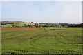
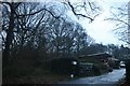
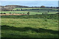
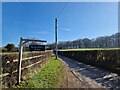
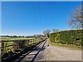
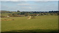
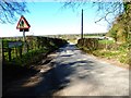
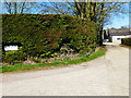
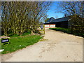
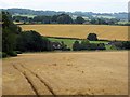
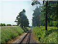
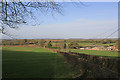
13 photos from this area
Area Information
Key information about the SO24 9SF including its size, population, and administrative classification.
- Area Type
- Postcode
- Area Size
- 2.1 km²
- Population
- 1557
- Population Density
- 54 people/km²
House Prices in SO24 9SF
20
Properties
£1,248,333
Average Sold Price
£400,000
Lowest Price
£2,375,000
Highest Price
Showing 20 properties
| Address | Type | Beds | Baths | Last Sale Price | Last Sale Date | |
|---|---|---|---|---|---|---|
| The Homestead, Barnetts Wood Lane, Bighton, SO24 9SF | house | - | - | £2,375,000 | Jul 2024 | |
| One Oak, Barnetts Wood Lane, Bighton, SO24 9SF | house | - | - | £970,000 | Sep 2013 | |
| Homegrove House, Barnetts Wood Lane, Bighton, SO24 9SF | Detached | - | - | £400,000 | May 1999 | |
| Barnetts Wood Farm, Barnetts Wood Lane, Bighton, SO24 9SF | Detached | 5 | 4 | - | - | |
| Bighton Grange, Barnetts Wood Lane, Bighton, SO24 9SF | house | 4 | - | - | - | |
| The Gem, Barnetts Wood Lane, Bighton, SO24 9SF | Detached | - | - | - | - | |
| Stable, Ranscombe Farm, Barnetts Wood Lane, Bighton, SO24 9SF | Equestrian | - | - | - | - | |
| Granary, Ranscombe Farm, Barnetts Wood Lane, Bighton, SO24 9SF | Farm | - | - | - | - | |
| Farm Building, Ranscombe Farm, Barnetts Wood Lane, Bighton, SO24 9SF | Farm | - | - | - | - | |
| Garage Flat, Takoma, Barnetts Wood Lane, Bighton, SO24 9SF | Flat | - | - | - | - |
Page 1 of 2
Energy Efficiency in SO24 9SF
Amenities
Schools
| Rank | School | Type | Entry gender | Ages |
|---|
Explore more schools in this area
Go to Schools tabDemographics
Household Size
Two person
most common
Accommodation Type
Houses
most common
Tenure
71
majority
Ethnic Group
White
most common
Religion
N/A
most common
Household Composition
N/A
most common
Age
47
median
Adults (30-64 years)
most common
Household Deprivation
N/A
with no deprivation
NS-SEC
42
in Lower managerial occupations
Explore more demographic insights in this area
Go to Demographics tabPlanning
Planning Constraints
- Flood RiskPremium
- Ramsar Wetland SitesPremium
- Area of Outstanding Natural BeautyPremium
- Protected Nature ReservePremium
- Protected WoodlandPremium