Area Overview for SO24 9EX
Photos of SO24 9EX
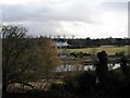
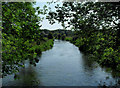
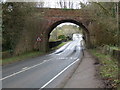
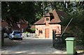
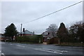


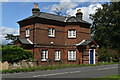
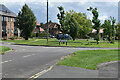
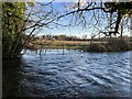
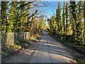
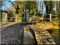
50 photos from this area
Area Information
Key information about the SO24 9EX including its size, population, and administrative classification.
- Area Type
- Postcode
- Area Size
- 30.4 hectares
- Population
- 1557
- Population Density
- 54 people/km²
House Prices in SO24 9EX
13
Properties
£803,000
Average Sold Price
£149,000
Lowest Price
£1,850,000
Highest Price
Showing 13 properties
| Address | Type | Beds | Baths | Last Sale Price | Last Sale Date | |
|---|---|---|---|---|---|---|
| Le Men Du, Drove Lane, Old Alresford, SO24 9EX | Detached | 4 | 2 | £1,850,000 | Nov 2024 | |
| Blandings, Drove Lane, Old Alresford, SO24 9EX | Detached | - | - | £410,000 | Nov 2007 | |
| Kestrels, Drove Lane, Old Alresford, SO24 9EX | Bungalow | - | - | £149,000 | Jul 1998 | |
| The Flat, Drovers Lake, Drove Lane, Old Alresford, SO24 9EX | Detached | 4 | 2 | - | - | |
| Drove Mead, Drove Lane, Old Alresford, SO24 9EX | Bungalow | 2 | 1 | - | - | |
| Drovers Brook, Drove Lane, Old Alresford, SO24 9EX | Flat | - | - | - | - | |
| Caravan At, Le Men Du, Drove Lane, Old Alresford, SO24 9EX | Mobile Home | - | - | - | - | |
| Franklyns Fish Farms Ltd, Drove Lane, Old Alresford, SO24 9EX | Farm | - | - | - | - | |
| Drovers Marsh, Drove Lane, Old Alresford, SO24 9EX | Detached | - | - | - | - | |
| Penrhyn, Drove Lane, Old Alresford, SO24 9EX | Detached | - | - | - | - |
Page 1 of 2
Energy Efficiency in SO24 9EX
Amenities
Schools
| Rank | School | Type | Entry gender | Ages |
|---|
Explore more schools in this area
Go to Schools tabDemographics
Household Size
Two person
most common
Accommodation Type
Houses
most common
Tenure
71
majority
Ethnic Group
White
most common
Religion
N/A
most common
Household Composition
N/A
most common
Age
47
median
Adults (30-64 years)
most common
Household Deprivation
N/A
with no deprivation
NS-SEC
42
in Lower managerial occupations
Explore more demographic insights in this area
Go to Demographics tabPlanning
Planning Constraints
- Flood RiskPremium
- Ramsar Wetland SitesPremium
- Area of Outstanding Natural BeautyPremium
- Protected Nature ReservePremium
- Protected WoodlandPremium