Area Overview for SO24 0DP
Photos of SO24 0DP
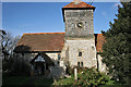
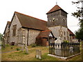
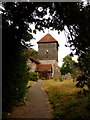
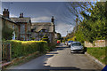
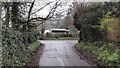
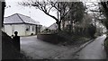
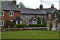
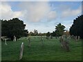
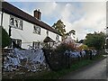
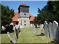
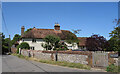
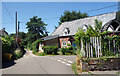
90 photos from this area
Area Information
Key information about the SO24 0DP including its size, population, and administrative classification.
- Area Type
- Postcode
- Area Size
- 1.3 hectares
- Population
- 2311
- Population Density
- 53 people/km²
House Prices in SO24 0DP
11
Properties
£570,125
Average Sold Price
£225,000
Lowest Price
£1,350,000
Highest Price
Showing 11 properties
| Address | Type | Beds | Baths | Last Sale Price | Last Sale Date | |
|---|---|---|---|---|---|---|
| Exeter House, Church Street, Ropley, Alresford, SO24 0DP | Detached | 4 | 2 | £1,350,000 | Jul 2024 | |
| Pondside Studio, Church Street, Ropley, Alresford, SO24 0DP | Detached | 3 | 2 | £395,000 | Mar 2020 | |
| ARCHBISHOP'S COTTAGE, CHURCH STREET, Ropley, Alresford, SO24 0DP | Detached | 2 | 2 | £338,000 | Jul 2019 | |
| Five Bells, Church Street, Ropley, Alresford, SO24 0DP | house | - | - | £350,000 | Nov 2013 | |
| Little Mount, Church Street, Ropley, Alresford, SO24 0DP | house | 3 | - | £843,000 | Feb 2010 | |
| Bell Cottage, Church Street, Ropley, Alresford, SO24 0DP | Terraced | - | - | £225,000 | Apr 2002 | |
| Town Street Farmhouse, Church Street, Ropley, Alresford, SO24 0DP | house | 5 | 3 | £825,000 | Sep 2000 | |
| Pondside Cottage, Church Street, Ropley, Alresford, SO24 0DP | Detached | 3 | 2 | £235,000 | Mar 1999 | |
| Eardley House, Church Street, Ropley, Alresford, SO24 0DP | Detached | 3 | 2 | - | - | |
| 3 Sunnyside Cottages, Church Street, Ropley, Alresford, SO24 0DP | Terraced | - | - | - | - |
Page 1 of 2
Energy Efficiency in SO24 0DP
Amenities
Schools
| Rank | School | Type | Entry gender | Ages |
|---|
Explore more schools in this area
Go to Schools tabDemographics
Household Size
Two person
most common
Accommodation Type
Houses
most common
Tenure
72
majority
Ethnic Group
White
most common
Religion
N/A
most common
Household Composition
N/A
most common
Age
47
median
Adults (30-64 years)
most common
Household Deprivation
N/A
with no deprivation
NS-SEC
47
in Lower managerial occupations
Explore more demographic insights in this area
Go to Demographics tabPlanning
Planning Constraints
- Flood RiskPremium
- Ramsar Wetland SitesPremium
- Area of Outstanding Natural BeautyPremium
- Protected Nature ReservePremium
- Protected WoodlandPremium