Area Overview for SO24 0AA
Photos of SO24 0AA
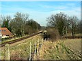
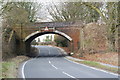
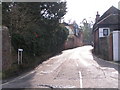
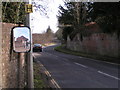
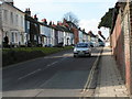
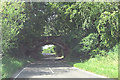
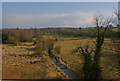
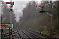
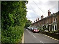

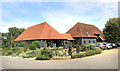

44 photos from this area
Area Information
Key information about the SO24 0AA including its size, population, and administrative classification.
- Area Type
- Postcode
- Area Size
- 1.5 km²
- Population
- 2223
- Population Density
- 34 people/km²
House Prices in SO24 0AA
42
Properties
£533,100
Average Sold Price
£250,000
Lowest Price
£1,500,000
Highest Price
Showing 42 properties
| Address | Type | Beds | Baths | Last Sale Price | Last Sale Date | |
|---|---|---|---|---|---|---|
| Darroford House, Bishops Sutton Road, Bishops Sutton, SO24 0AA | Semi-detached | 4 | 3 | £539,500 | May 2015 | |
| Sutton House, Bishops Sutton Road, Bishops Sutton, SO24 0AA | Detached | 4 | - | £640,000 | Mar 2014 | |
| Dell House, Bishops Sutton Road, Bishops Sutton, SO24 0AA | Detached | 5 | 2 | £525,000 | Jul 2012 | |
| Pear Tree Cottage, Mill Lane, Bishops Sutton, SO24 0AA | Bungalow | - | - | £351,001 | Sep 2009 | |
| Florence Villa, Bishops Sutton Road, Bishops Sutton, SO24 0AA | Terraced | 3 | - | £292,000 | Aug 2007 | |
| Pembroke Cottage, Bishops Sutton Road, Bishops Sutton, SO24 0AA | Detached | - | - | £467,500 | Jun 2007 | |
| Pickwick Cottage, Bishops Sutton Road, Bishops Sutton, SO24 0AA | house | - | - | £366,000 | Dec 2005 | |
| Harbours, Bishops Sutton Road, Bishops Sutton, SO24 0AA | house | - | - | £400,000 | Sep 2003 | |
| Arle House, Mill Lane, Bishops Sutton, SO24 0AA | house | - | - | £1,500,000 | Jul 2001 | |
| Mill Lane Cottage, Bishops Sutton Road, Bishops Sutton, SO24 0AA | Bungalow | 2 | - | £250,000 | Oct 1997 |
Page 1 of 5
Energy Efficiency in SO24 0AA
Amenities
Schools
| Rank | School | Type | Entry gender | Ages |
|---|
Explore more schools in this area
Go to Schools tabDemographics
Household Size
Two person
most common
Accommodation Type
Houses
most common
Tenure
66
majority
Ethnic Group
White
most common
Religion
N/A
most common
Household Composition
N/A
most common
Age
47
median
Adults (30-64 years)
most common
Household Deprivation
N/A
with no deprivation
NS-SEC
48
in Lower managerial occupations
Explore more demographic insights in this area
Go to Demographics tabPlanning
Planning Constraints
- Flood RiskPremium
- Ramsar Wetland SitesPremium
- Area of Outstanding Natural BeautyPremium
- Protected Nature ReservePremium
- Protected WoodlandPremium