Area Overview for SO23 8GF
Photos of SO23 8GF
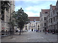
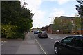
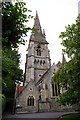
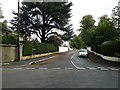
100 photos from this area
Area Information
Key information about the SO23 8GF including its size, population, and administrative classification.
- Area Type
- Postcode
- Area Size
- 4855 m²
- Population
- 2047
- Population Density
- 3437 people/km²
House Prices in SO23 8GF
15
Properties
£583,863
Average Sold Price
£142,000
Lowest Price
£820,000
Highest Price
Showing 15 properties
| Address | Type | Beds | Baths | Last Sale Price | Last Sale Date | |
|---|---|---|---|---|---|---|
| 12 Beaumond Green, Winchester, SO23 8GF | house | - | - | £820,000 | Sep 2025 | |
| 11 Beaumond Green, Winchester, SO23 8GF | Terraced | 3 | 2 | £770,000 | Jan 2023 | |
| 15 Beaumond Green, Winchester, SO23 8GF | Terraced | 3 | 2 | £760,000 | Jun 2022 | |
| 5 Beaumond Green, Winchester, SO23 8GF | Terraced | 3 | 2 | £750,000 | Jun 2022 | |
| 4 Beaumond Green, Winchester, SO23 8GF | Terraced | 3 | - | £725,000 | Aug 2021 | |
| 6 Beaumond Green, Winchester, SO23 8GF | house | - | - | £695,000 | Jul 2020 | |
| 2 Beaumond Green, Winchester, SO23 8GF | Terraced | 3 | 2 | £725,000 | Aug 2019 | |
| 1 Beaumond Green, Winchester, SO23 8GF | house | - | - | £700,000 | Apr 2019 | |
| 10 Beaumond Green, Winchester, SO23 8GF | Semi-detached | 3 | 1 | £660,000 | Apr 2016 | |
| 8 Beaumond Green, Winchester, SO23 8GF | house | 3 | - | £630,000 | Apr 2015 |
Page 1 of 2
Energy Efficiency in SO23 8GF
Amenities
Schools
| Rank | School | Type | Entry gender | Ages |
|---|
Explore more schools in this area
Go to Schools tabDemographics
Household Size
Two person
most common
Accommodation Type
Houses
most common
Tenure
63
majority
Ethnic Group
White
most common
Religion
N/A
most common
Household Composition
N/A
most common
Age
22
median
Young Adults (15-29 years)
most common
Household Deprivation
N/A
with no deprivation
NS-SEC
42
in Lower managerial occupations
Explore more demographic insights in this area
Go to Demographics tabPlanning
Planning Constraints
- Flood RiskPremium
- Ramsar Wetland SitesPremium
- Area of Outstanding Natural BeautyPremium
- Protected Nature ReservePremium
- Protected WoodlandPremium