Area Overview for SO23 7QN
Photos of SO23 7QN
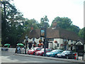
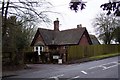
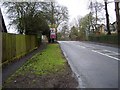
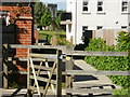
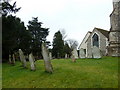
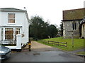
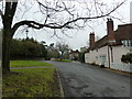
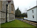
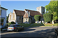
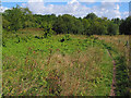
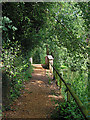

90 photos from this area
Area Information
Key information about the SO23 7QN including its size, population, and administrative classification.
- Area Type
- Postcode
- Area Size
- 4.5 hectares
- Population
- 1664
- Population Density
- 1065 people/km²
House Prices in SO23 7QN
24
Properties
£585,443
Average Sold Price
£175,000
Lowest Price
£1,175,000
Highest Price
Showing 24 properties
| Address | Type | Beds | Baths | Last Sale Price | Last Sale Date | |
|---|---|---|---|---|---|---|
| Old Post Office, London Road, Kings Worthy, SO23 7QN | Detached | 6 | 4 | £1,120,000 | Sep 2021 | |
| 1, Victoria Cottages, London Road, Kings Worthy, SO23 7QN | Semi-detached | 4 | 2 | £517,000 | Apr 2021 | |
| Wistaria, London Road, Kings Worthy, SO23 7QN | house | - | - | £522,103 | Nov 2012 | |
| The Village Forge, London Road, Kings Worthy, SO23 7QN | house | - | - | £342,000 | Jan 2011 | |
| Northleigh, London Road, Kings Worthy, SO23 7QN | Detached | 2 | 2 | £1,175,000 | Aug 2002 | |
| The Reading Room, London Road, Kings Worthy, SO23 7QN | Detached | - | - | £247,000 | May 2001 | |
| Ambury, St Marys Close, Kings Worthy, SO23 7QN | Bungalow | - | - | £175,000 | May 1998 | |
| Eversley Cottage, London Road, Kings Worthy, SO23 7QN | Detached | 7 | 4 | - | - | |
| Annexe, Eversley Cottage, London Road, Kings Worthy, SO23 7QN | Detached | 2 | - | - | - | |
| The Cottage, London Road, Kings Worthy, SO23 7QN | Detached | 8 | 2 | - | - |
Page 1 of 3
Energy Efficiency in SO23 7QN
Amenities
Schools
| Rank | School | Type | Entry gender | Ages |
|---|
Explore more schools in this area
Go to Schools tabDemographics
Household Size
Two person
most common
Accommodation Type
Houses
most common
Tenure
83
majority
Ethnic Group
White
most common
Religion
N/A
most common
Household Composition
N/A
most common
Age
47
median
Adults (30-64 years)
most common
Household Deprivation
N/A
with no deprivation
NS-SEC
59
in Lower managerial occupations
Explore more demographic insights in this area
Go to Demographics tabPlanning
Planning Constraints
- Flood RiskPremium
- Ramsar Wetland SitesPremium
- Area of Outstanding Natural BeautyPremium
- Protected Nature ReservePremium
- Protected WoodlandPremium