Area Overview for SO23 7NZ
Photos of SO23 7NZ
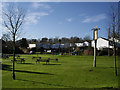
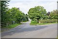
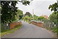
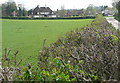
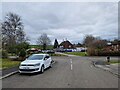
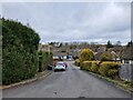
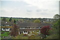
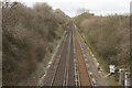
50 photos from this area
Area Information
Key information about the SO23 7NZ including its size, population, and administrative classification.
- Area Type
- Postcode
- Area Size
- 1.8 hectares
- Population
- 1469
- Population Density
- 3417 people/km²
House Prices in SO23 7NZ
29
Properties
£430,208
Average Sold Price
£190,000
Lowest Price
£895,000
Highest Price
Showing 29 properties
| Address | Type | Beds | Baths | Last Sale Price | Last Sale Date | |
|---|---|---|---|---|---|---|
| Kingsdown, North Road, Kings Worthy, SO23 7NZ | Detached | 5 | 3 | £895,000 | Dec 2024 | |
| 8 North Road, Kings Worthy, SO23 7NZ | house | 3 | - | £425,000 | Jan 2021 | |
| Alfresco, North Road, Kings Worthy, SO23 7NZ | Bungalow | - | - | £515,000 | Jan 2021 | |
| 11 North Road, Kings Worthy, SO23 7NZ | house | - | - | £375,000 | Mar 2020 | |
| Montanaro, North Road, Kings Worthy, SO23 7NZ | Detached | - | - | £394,000 | Nov 2019 | |
| 17 North Road, Kings Worthy, SO23 7NZ | Semi-detached | 3 | 1 | £350,000 | Oct 2019 | |
| Eden House, North Road, Kings Worthy, SO23 7NZ | Bungalow | 3 | 3 | £435,000 | Aug 2019 | |
| 12 North Road, Kings Worthy, SO23 7NZ | Semi-detached | 3 | 1 | £320,000 | Jul 2019 | |
| High Lees, North Road, Kings Worthy, SO23 7NZ | Bungalow | 5 | 3 | £565,000 | Oct 2017 | |
| 10 North Road, Kings Worthy, SO23 7NZ | Semi-detached | 5 | - | £282,000 | May 2013 |
Page 1 of 3
Energy Efficiency in SO23 7NZ
Amenities
Schools
| Rank | School | Type | Entry gender | Ages |
|---|
Explore more schools in this area
Go to Schools tabDemographics
Household Size
Two person
most common
Accommodation Type
Houses
most common
Tenure
49
majority
Ethnic Group
White
most common
Religion
N/A
most common
Household Composition
N/A
most common
Age
47
median
Adults (30-64 years)
most common
Household Deprivation
N/A
with no deprivation
NS-SEC
37
in Lower managerial occupations
Explore more demographic insights in this area
Go to Demographics tabPlanning
Planning Constraints
- Flood RiskPremium
- Ramsar Wetland SitesPremium
- Area of Outstanding Natural BeautyPremium
- Protected Nature ReservePremium
- Protected WoodlandPremium