Area Overview for SO23 0QD
Photos of SO23 0QD
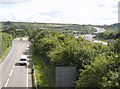
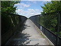
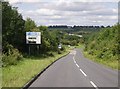
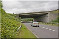


62 photos from this area
Area Information
Key information about the SO23 0QD including its size, population, and administrative classification.
- Area Type
- Postcode
- Area Size
- 2.0 hectares
- Population
- 1609
- Population Density
- 4829 people/km²
House Prices in SO23 0QD
41
Properties
£284,257
Average Sold Price
£101,000
Lowest Price
£750,000
Highest Price
Showing 41 properties
| Address | Type | Beds | Baths | Last Sale Price | Last Sale Date | |
|---|---|---|---|---|---|---|
| 3 St Leonards Road, Winchester, SO23 0QD | Detached | 3 | 2 | £750,000 | May 2023 | |
| 19 St Leonards Road, Winchester, SO23 0QD | Retail | 3 | 1 | £487,500 | Sep 2022 | |
| 33 St Leonards Road, Winchester, SO23 0QD | Flat | - | - | £177,000 | Jun 2021 | |
| 12 St Leonards Road, Winchester, SO23 0QD | house | 3 | 1 | £530,000 | Jun 2021 | |
| 5 St Leonards Road, Winchester, SO23 0QD | house | 3 | - | £458,605 | Feb 2020 | |
| 6 St Leonards Road, Winchester, SO23 0QD | Semi-detached | 2 | 1 | £475,000 | Dec 2017 | |
| 36 St Leonards Road, Winchester, SO23 0QD | Flat | - | - | £175,000 | Mar 2016 | |
| 35 St Leonards Road, Winchester, SO23 0QD | Flat | - | - | £147,500 | Mar 2016 | |
| 34 St Leonards Road, Winchester, SO23 0QD | Flat | - | - | £185,000 | Mar 2016 | |
| 10 St Leonards Road, Winchester, SO23 0QD | Semi-detached | 3 | 1 | £401,250 | Sep 2015 |
Page 1 of 5
Energy Efficiency in SO23 0QD
Amenities
Schools
| Rank | School | Type | Entry gender | Ages |
|---|
Explore more schools in this area
Go to Schools tabDemographics
Household Size
One person
most common
Accommodation Type
Houses
most common
Tenure
48
majority
Ethnic Group
White
most common
Religion
N/A
most common
Household Composition
N/A
most common
Age
47
median
Adults (30-64 years)
most common
Household Deprivation
N/A
with no deprivation
NS-SEC
43
in Lower managerial occupations
Explore more demographic insights in this area
Go to Demographics tabPlanning
Planning Constraints
- Flood RiskPremium
- Ramsar Wetland SitesPremium
- Area of Outstanding Natural BeautyPremium
- Protected Nature ReservePremium
- Protected WoodlandPremium