Area Overview for SO23 0NT
Photos of SO23 0NT

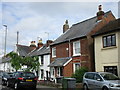
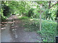
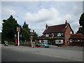
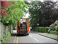

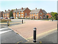
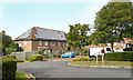
92 photos from this area
Area Information
Key information about the SO23 0NT including its size, population, and administrative classification.
- Area Type
- Postcode
- Area Size
- 2.7 hectares
- Population
- 1571
- Population Density
- 854 people/km²
House Prices in SO23 0NT
48
Properties
£249,867
Average Sold Price
£82,000
Lowest Price
£450,000
Highest Price
Showing 48 properties
| Address | Type | Beds | Baths | Last Sale Price | Last Sale Date | |
|---|---|---|---|---|---|---|
| 72 Longfield Road, Winchester, SO23 0NT | Detached | 3 | 1 | £281,500 | Dec 2025 | |
| 48 Longfield Road, Winchester, SO23 0NT | Semi-detached | 4 | 1 | £348,000 | Feb 2025 | |
| 38 Longfield Road, Winchester, SO23 0NT | Semi-detached | 1 | 1 | £450,000 | Nov 2024 | |
| 54 Longfield Road, Winchester, SO23 0NT | Semi-detached | 4 | 1 | £357,500 | Oct 2022 | |
| 28 Longfield Road, Winchester, SO23 0NT | house | - | - | £355,000 | Mar 2021 | |
| 44 Longfield Road, Winchester, SO23 0NT | house | - | - | £350,000 | Feb 2018 | |
| 4 Longfield Road, Winchester, SO23 0NT | Semi-detached | 4 | 1 | £289,000 | Jun 2014 | |
| 40 Longfield Road, Winchester, SO23 0NT | house | - | - | £220,000 | Nov 2013 | |
| 2 Longfield Road, Winchester, SO23 0NT | Semi-detached | 4 | 1 | £270,000 | Jul 2013 | |
| 82 Longfield Road, Winchester, SO23 0NT | house | 3 | 1 | £230,000 | Dec 2011 |
Page 1 of 5
Energy Efficiency in SO23 0NT
Amenities
Schools
| Rank | School | Type | Entry gender | Ages |
|---|
Explore more schools in this area
Go to Schools tabDemographics
Household Size
Family (3-5 people)
most common
Accommodation Type
Houses
most common
Tenure
45
majority
Ethnic Group
White
most common
Religion
N/A
most common
Household Composition
N/A
most common
Age
47
median
Adults (30-64 years)
most common
Household Deprivation
N/A
with no deprivation
NS-SEC
32
in Lower managerial occupations
Explore more demographic insights in this area
Go to Demographics tabPlanning
Planning Constraints
- Flood RiskPremium
- Ramsar Wetland SitesPremium
- Area of Outstanding Natural BeautyPremium
- Protected Nature ReservePremium
- Protected WoodlandPremium