Area Overview for SO22 5QS
Photos of SO22 5QS
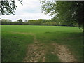
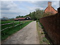
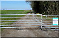
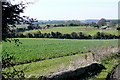
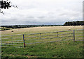
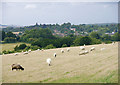
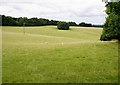
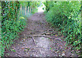
18 photos from this area
Area Information
Key information about the SO22 5QS including its size, population, and administrative classification.
- Area Type
- Postcode
- Area Size
- 1.7 km²
- Population
- 2665
- Population Density
- 73 people/km²
House Prices in SO22 5QS
18
Properties
£1,021,250
Average Sold Price
£285,000
Lowest Price
£1,500,000
Highest Price
Showing 18 properties
| Address | Type | Beds | Baths | Last Sale Price | Last Sale Date | |
|---|---|---|---|---|---|---|
| Crabwood Barn, Sarum Road, Winchester, SO22 5QS | house | - | - | £1,500,000 | Apr 2024 | |
| Crabwood Farm House, Sarum Road, Winchester, SO22 5QS | Detached | 5 | - | £1,250,000 | Jan 2019 | |
| Crabwood Lodge, Sarum Road, Winchester, SO22 5QS | house | - | - | £1,050,000 | Feb 2018 | |
| West Cottage, Sarum Road, Winchester, SO22 5QS | Detached | 5 | 3 | £285,000 | Jul 2005 | |
| Mobile Home At, Beechcroft, Sarum Road, Winchester, SO22 5QS | Detached | 6 | - | - | - | |
| Hcc Countryside Service, Crabwood, Sarum Road, Winchester, SO22 5QS | Office | - | - | - | - | |
| Tennis 104M From Crabwood House, Sarum Road 117M From Sarum Road, Sarum Road, Sparsholt, SO22 5QS | Leisure | - | - | - | - | |
| Crabwood Vale Farm, Sarum Road, Winchester, SO22 5QS | Detached | - | - | - | - | |
| Workshop At Sarum Farm, Sarum Road, Winchester, SO22 5QS | Industrial | - | - | - | - | |
| East Cottage, Sarum Road, Winchester, SO22 5QS | Semi-detached | - | - | - | - |
Page 1 of 2
Energy Efficiency in SO22 5QS
Amenities
Schools
| Rank | School | Type | Entry gender | Ages |
|---|
Explore more schools in this area
Go to Schools tabDemographics
Household Size
Family (3-5 people)
most common
Accommodation Type
Houses
most common
Tenure
73
majority
Ethnic Group
White
most common
Religion
N/A
most common
Household Composition
N/A
most common
Age
47
median
Adults (30-64 years)
most common
Household Deprivation
N/A
with no deprivation
NS-SEC
49
in Lower managerial occupations
Explore more demographic insights in this area
Go to Demographics tabPlanning
Planning Constraints
- Flood RiskPremium
- Ramsar Wetland SitesPremium
- Area of Outstanding Natural BeautyPremium
- Protected Nature ReservePremium
- Protected WoodlandPremium