Area Overview for SO22 5PJ
Photos of SO22 5PJ
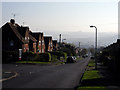
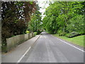
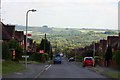
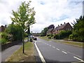
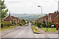
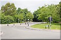
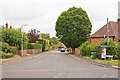
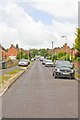

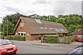
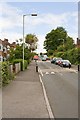
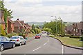
69 photos from this area
Area Information
Key information about the SO22 5PJ including its size, population, and administrative classification.
- Area Type
- Postcode
- Area Size
- 2.1 hectares
- Population
- 2089
- Population Density
- 2503 people/km²
House Prices in SO22 5PJ
14
Properties
£624,444
Average Sold Price
£195,000
Lowest Price
£1,065,000
Highest Price
Showing 14 properties
| Address | Type | Beds | Baths | Last Sale Price | Last Sale Date | |
|---|---|---|---|---|---|---|
| 94 Romsey Road, Winchester, SO22 5PJ | house | - | - | £860,000 | Mar 2021 | |
| 90 Romsey Road, Winchester, SO22 5PJ | Detached | 5 | - | £1,065,000 | Mar 2018 | |
| St Catherines, 98 Romsey Road, Winchester, SO22 5PJ | house | - | - | £995,000 | Dec 2017 | |
| 92 Romsey Road, Winchester, SO22 5PJ | Detached | 5 | - | £900,000 | Jul 2014 | |
| 112 Romsey Road, Winchester, SO22 5PJ | house | - | - | £620,000 | Nov 2009 | |
| 86 Romsey Road, Winchester, SO22 5PJ | Detached | - | - | £480,000 | Jan 2003 | |
| 102 Romsey Road, Winchester, SO22 5PJ | house | - | - | £280,000 | Mar 2001 | |
| 96 Romsey Road, Winchester, SO22 5PJ | Detached | 5 | 3 | £195,000 | Oct 1998 | |
| 104 Romsey Road, Winchester, SO22 5PJ | Detached | - | - | £225,000 | Sep 1998 | |
| Downedge, 110 Romsey Road, Winchester, SO22 5PJ | Detached | 5 | 2 | - | - |
Page 1 of 2
Energy Efficiency in SO22 5PJ
Amenities
Schools
| Rank | School | Type | Entry gender | Ages |
|---|
Explore more schools in this area
Go to Schools tabDemographics
Household Size
Family (3-5 people)
most common
Accommodation Type
Houses
most common
Tenure
66
majority
Ethnic Group
White
most common
Religion
N/A
most common
Household Composition
N/A
most common
Age
47
median
Adults (30-64 years)
most common
Household Deprivation
N/A
with no deprivation
NS-SEC
47
in Lower managerial occupations
Explore more demographic insights in this area
Go to Demographics tabPlanning
Planning Constraints
- Flood RiskPremium
- Ramsar Wetland SitesPremium
- Area of Outstanding Natural BeautyPremium
- Protected Nature ReservePremium
- Protected WoodlandPremium