Area Overview for SO22 5LN
Photos of SO22 5LN
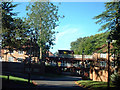
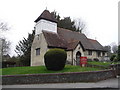
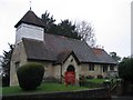

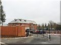
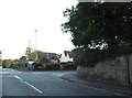


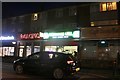
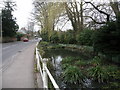
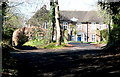

43 photos from this area
Area Information
Key information about the SO22 5LN including its size, population, and administrative classification.
- Area Type
- Postcode
- Area Size
- 3.1 hectares
- Population
- 1735
- Population Density
- 2575 people/km²
House Prices in SO22 5LN
25
Properties
£761,359
Average Sold Price
£312,000
Lowest Price
£1,350,000
Highest Price
Showing 25 properties
| Address | Type | Beds | Baths | Last Sale Price | Last Sale Date | |
|---|---|---|---|---|---|---|
| 3 Old Hillside Road, Winchester, SO22 5LN | Detached | 3 | 1 | £875,000 | Nov 2025 | |
| Little Dunthrop, Old Hillside Road, Winchester, SO22 5LN | Detached | - | - | £1,350,000 | Dec 2023 | |
| 1 Old Hillside Road, Winchester, SO22 5LN | Detached | 4 | 2 | £1,165,000 | Jun 2023 | |
| Fonbrig, Old Hillside Road, Winchester, SO22 5LN | Bungalow | 3 | 2 | £675,000 | Dec 2020 | |
| Merveldene, Old Hillside Road, Winchester, SO22 5LN | Bungalow | - | - | £600,000 | Mar 2020 | |
| 19 Old Hillside Road, Winchester, SO22 5LN | house | - | - | £1,140,000 | Jan 2019 | |
| West Heaton, Old Hillside Road, Winchester, SO22 5LN | house | - | - | £1,050,000 | May 2017 | |
| Summerdown, 9 Old Hillside Road, Winchester, SO22 5LN | Bungalow | - | - | £655,500 | May 2016 | |
| Cedar Lodge, Old Hillside Road, Winchester, SO22 5LN | Detached | 4 | - | £824,250 | Jun 2013 | |
| Tamarisk, Old Hillside Road, Winchester, SO22 5LN | house | - | - | £600,000 | Aug 2012 |
Page 1 of 3
Energy Efficiency in SO22 5LN
Amenities
Schools
| Rank | School | Type | Entry gender | Ages |
|---|
Explore more schools in this area
Go to Schools tabDemographics
Household Size
Two person
most common
Accommodation Type
Houses
most common
Tenure
91
majority
Ethnic Group
White
most common
Religion
N/A
most common
Household Composition
N/A
most common
Age
47
median
Adults (30-64 years)
most common
Household Deprivation
N/A
with no deprivation
NS-SEC
61
in Lower managerial occupations
Explore more demographic insights in this area
Go to Demographics tabPlanning
Planning Constraints
- Flood RiskPremium
- Ramsar Wetland SitesPremium
- Area of Outstanding Natural BeautyPremium
- Protected Nature ReservePremium
- Protected WoodlandPremium