Area Overview for SO22 4QL
Photos of SO22 4QL
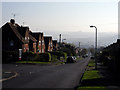
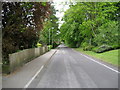
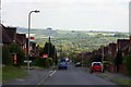
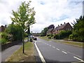
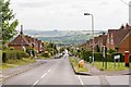
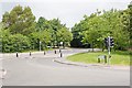
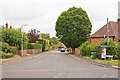
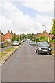

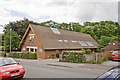
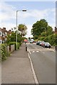
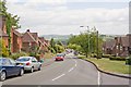
69 photos from this area
Area Information
Key information about the SO22 4QL including its size, population, and administrative classification.
- Area Type
- Postcode
- Area Size
- 2.4 hectares
- Population
- 1218
- Population Density
- 4506 people/km²
House Prices in SO22 4QL
31
Properties
£354,327
Average Sold Price
£105,995
Lowest Price
£630,000
Highest Price
Showing 31 properties
| Address | Type | Beds | Baths | Last Sale Price | Last Sale Date | |
|---|---|---|---|---|---|---|
| 27 Wheatland Close, Badger Farm, SO22 4QL | Detached | 3 | 1 | £525,000 | Mar 2025 | |
| 31 Wheatland Close, Badger Farm, SO22 4QL | house | - | - | £545,000 | Feb 2022 | |
| 29 Wheatland Close, Badger Farm, SO22 4QL | Retail | 4 | 2 | £630,000 | Jan 2022 | |
| 10 Wheatland Close, Badger Farm, SO22 4QL | Detached | 3 | 2 | £535,000 | Oct 2021 | |
| 16 Wheatland Close, Badger Farm, SO22 4QL | Detached | 3 | 2 | £470,000 | Dec 2020 | |
| 22 Wheatland Close, Badger Farm, SO22 4QL | house | - | - | £472,500 | Oct 2017 | |
| 28 Wheatland Close, Badger Farm, SO22 4QL | Detached | - | - | £625,000 | Apr 2017 | |
| 19 Wheatland Close, Badger Farm, SO22 4QL | house | - | - | £570,000 | Aug 2016 | |
| 2 Wheatland Close, Badger Farm, SO22 4QL | Detached | 3 | - | £377,500 | Aug 2015 | |
| 8 Wheatland Close, Badger Farm, SO22 4QL | Detached | 4 | - | £450,000 | Jul 2014 |
Page 1 of 4
Energy Efficiency in SO22 4QL
Amenities
Schools
| Rank | School | Type | Entry gender | Ages |
|---|
Explore more schools in this area
Go to Schools tabDemographics
Household Size
Two person
most common
Accommodation Type
Houses
most common
Tenure
81
majority
Ethnic Group
White
most common
Religion
N/A
most common
Household Composition
N/A
most common
Age
47
median
Adults (30-64 years)
most common
Household Deprivation
N/A
with no deprivation
NS-SEC
55
in Lower managerial occupations
Explore more demographic insights in this area
Go to Demographics tabPlanning
Planning Constraints
- Flood RiskPremium
- Ramsar Wetland SitesPremium
- Area of Outstanding Natural BeautyPremium
- Protected Nature ReservePremium
- Protected WoodlandPremium