Area Overview for SO22 4NA
Photos of SO22 4NA
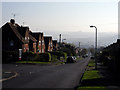
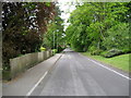
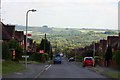
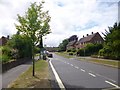
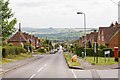
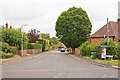
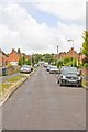

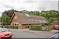
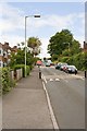
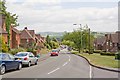
69 photos from this area
Area Information
Key information about the SO22 4NA including its size, population, and administrative classification.
- Area Type
- Postcode
- Area Size
- 4.0 hectares
- Population
- 2047
- Population Density
- 3437 people/km²
House Prices in SO22 4NA
19
Properties
£1,655,813
Average Sold Price
£575,000
Lowest Price
£3,100,000
Highest Price
Showing 19 properties
| Address | Type | Beds | Baths | Last Sale Price | Last Sale Date | |
|---|---|---|---|---|---|---|
| The Laurels, Sleepers Hill, Winchester, SO22 4NA | Detached | 5 | 4 | £1,850,000 | Jan 2024 | |
| Holybourne, St Catherines Place, Sleepers Hill, Winchester, SO22 4NA | Detached | 5 | 5 | £1,500,000 | Jan 2024 | |
| Little Snakemoor, Sleepers Hill, Winchester, SO22 4NA | house | 6 | - | £3,100,000 | Feb 2022 | |
| Abbotswood, Sleepers Hill, Winchester, SO22 4NA | house | - | - | £1,446,500 | Aug 2019 | |
| Pelham House, Sleepers Hill, Winchester, SO22 4NA | Detached | 7 | 3 | £1,925,000 | Nov 2015 | |
| Orchard House, Sleepers Hill, Winchester, SO22 4NA | Detached | - | - | £1,100,000 | Oct 2013 | |
| Summer House, Sleepers Hill, Winchester, SO22 4NA | house | - | - | £1,750,000 | Dec 2009 | |
| Little Robertson, Sleepers Hill, Winchester, SO22 4NA | Detached | 5 | 4 | £575,000 | Mar 1999 | |
| Kingsley, The Holt, Sleepers Hill, Winchester, SO22 4NA | Detached | 5 | 5 | - | - | |
| Wayfarer, The Holt, Sleepers Hill, Winchester, SO22 4NA | Semi-detached | 5 | 5 | - | - |
Page 1 of 2
Energy Efficiency in SO22 4NA
Amenities
Schools
| Rank | School | Type | Entry gender | Ages |
|---|
Explore more schools in this area
Go to Schools tabDemographics
Household Size
Two person
most common
Accommodation Type
Houses
most common
Tenure
63
majority
Ethnic Group
White
most common
Religion
N/A
most common
Household Composition
N/A
most common
Age
22
median
Young Adults (15-29 years)
most common
Household Deprivation
N/A
with no deprivation
NS-SEC
42
in Lower managerial occupations
Explore more demographic insights in this area
Go to Demographics tabPlanning
Planning Constraints
- Flood RiskPremium
- Ramsar Wetland SitesPremium
- Area of Outstanding Natural BeautyPremium
- Protected Nature ReservePremium
- Protected WoodlandPremium