Area Overview for SO21 2PJ
Photos of SO21 2PJ
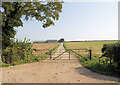
![Entrance to Folly Farm Oil Site [Weald Basin] in SO21 2PJ](https://images.propbar.co.uk/images/geograph/49/83/4983273_120.jpg)
17 photos from this area
Area Information
Key information about the SO21 2PJ including its size, population, and administrative classification.
- Area Type
- Postcode
- Area Size
- 69.7 hectares
- Population
- 2665
- Population Density
- 73 people/km²
House Prices in SO21 2PJ
4
Properties
-
Average Sold Price
-
Lowest Price
-
Highest Price
Showing 4 properties
| Address | Type | Beds | Baths | Last Sale Price | Last Sale Date | |
|---|---|---|---|---|---|---|
| Kirton Farm House, Stockbridge Road, Crawley, SO21 2PJ | Detached | - | - | - | - | |
| 2, Kirton Cottages, Stockbridge Road, Crawley, SO21 2PJ | house | - | - | - | - | |
| 1, Kirton Cottages, Stockbridge Road, Crawley, SO21 2PJ | house | - | - | - | - | |
| Kirton Farm Nurseries Ltd, Stockbridge Road, Crawley, SO21 2PJ | Farm | - | - | - | - |
Energy Efficiency in SO21 2PJ
Amenities
Schools
| Rank | School | Type | Entry gender | Ages |
|---|
Explore more schools in this area
Go to Schools tabDemographics
Household Size
Family (3-5 people)
most common
Accommodation Type
Houses
most common
Tenure
73
majority
Ethnic Group
White
most common
Religion
N/A
most common
Household Composition
N/A
most common
Age
47
median
Adults (30-64 years)
most common
Household Deprivation
N/A
with no deprivation
NS-SEC
49
in Lower managerial occupations
Explore more demographic insights in this area
Go to Demographics tabPlanning
Planning Constraints
- Flood RiskPremium
- Ramsar Wetland SitesPremium
- Area of Outstanding Natural BeautyPremium
- Protected Nature ReservePremium
- Protected WoodlandPremium