Area Overview for SO21 1TD
Photos of SO21 1TD


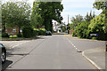
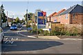
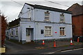

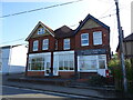


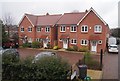
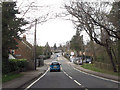
25 photos from this area
Area Information
Key information about the SO21 1TD including its size, population, and administrative classification.
- Area Type
- Postcode
- Area Size
- 1.4 hectares
- Population
- 2279
- Population Density
- 813 people/km²
House Prices in SO21 1TD
9
Properties
£285,383
Average Sold Price
£262,500
Lowest Price
£300,000
Highest Price
Showing 9 properties
| Address | Type | Beds | Baths | Last Sale Price | Last Sale Date | |
|---|---|---|---|---|---|---|
| The Cottage, 82 Main Road, Colden Common, SO21 1TD | Semi-detached | 2 | 1 | £262,500 | Mar 2018 | |
| Park House, 80 Main Road, Colden Common, SO21 1TD | house | - | - | £300,000 | Jun 2016 | |
| Water House, 84 Main Road, Colden Common, SO21 1TD | Semi-detached | 2 | 1 | £293,650 | Mar 2004 | |
| 1, Glen Cottages, 110 Main Road, Colden Common, SO21 1TD | Semi-detached | 3 | - | - | - | |
| Fishers Cottage, 86 Main Road, Colden Common, SO21 1TD | Semi-detached | - | - | - | - | |
| A E And B Mathews Transport Ltd, Main Road, Colden Common, SO21 1TD | warehouse | - | - | - | - | |
| 2, Glen Cottages, 108 Main Road, Colden Common, SO21 1TD | Semi-detached | 2 | 1 | - | - | |
| Workshop, Clayfield Caravans, Main Road, Colden Common, SO21 1TD | Industrial | - | - | - | - | |
| The Laurel, 88 Main Road, Colden Common, SO21 1TD | Detached | - | - | - | - |
Energy Efficiency in SO21 1TD
Amenities
Schools
| Rank | School | Type | Entry gender | Ages |
|---|
Explore more schools in this area
Go to Schools tabDemographics
Household Size
Two person
most common
Accommodation Type
Houses
most common
Tenure
88
majority
Ethnic Group
White
most common
Religion
N/A
most common
Household Composition
N/A
most common
Age
47
median
Adults (30-64 years)
most common
Household Deprivation
N/A
with no deprivation
NS-SEC
50
in Lower managerial occupations
Explore more demographic insights in this area
Go to Demographics tabPlanning
Planning Constraints
- Flood RiskPremium
- Ramsar Wetland SitesPremium
- Area of Outstanding Natural BeautyPremium
- Protected Nature ReservePremium
- Protected WoodlandPremium