Area Overview for SO21 1HF
Photos of SO21 1HF
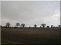
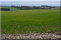

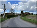
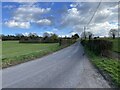
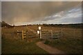
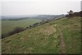
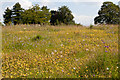
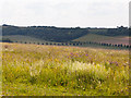
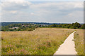


24 photos from this area
Area Information
Key information about the SO21 1HF including its size, population, and administrative classification.
- Area Type
- Postcode
- Area Size
- 65.5 hectares
- Population
- 2019
- Population Density
- 28 people/km²
House Prices in SO21 1HF
15
Properties
£503,000
Average Sold Price
£80,000
Lowest Price
£1,055,000
Highest Price
Showing 15 properties
| Address | Type | Beds | Baths | Last Sale Price | Last Sale Date | |
|---|---|---|---|---|---|---|
| Fairhaven, Fair Lane, Winchester, SO21 1HF | Bungalow | 4 | 2 | £640,000 | Oct 2018 | |
| Maple House, Fair Lane, Winchester, SO21 1HF | house | - | - | £655,000 | Nov 2016 | |
| Winnall Down Farm House, Fair Lane, Winchester, SO21 1HF | storage_distribution | - | - | £1,055,000 | Oct 2005 | |
| Kemari, Fair Lane, Winchester, SO21 1HF | house | - | - | £85,000 | Dec 1998 | |
| 2, New Cottages, Fair Lane, Winchester, SO21 1HF | house | - | - | £80,000 | Oct 1996 | |
| Dairy Cottage, Fair Lane, Winchester, SO21 1HF | house | 2 | - | - | - | |
| Mobile Home At, Kemari, Fair Lane, Winchester, SO21 1HF | Mobile Home | - | - | - | - | |
| The Winchester Carriage Company, Store And Compound, Daffodil Bungalow, Fair Lane, Winchester, SO21 1HF | warehouse | - | - | - | - | |
| 1 The Cottage, Winnall Down Farm, Fair Lane, Winchester, SO21 1HF | Semi-detached | 2 | 1 | - | - | |
| 2 The Cottage, Winnall Down Farm, Fair Lane, Winchester, SO21 1HF | house | - | - | - | - |
Page 1 of 2
Energy Efficiency in SO21 1HF
Amenities
Schools
| Rank | School | Type | Entry gender | Ages |
|---|
Explore more schools in this area
Go to Schools tabDemographics
Household Size
Two person
most common
Accommodation Type
Houses
most common
Tenure
71
majority
Ethnic Group
White
most common
Religion
N/A
most common
Household Composition
N/A
most common
Age
47
median
Adults (30-64 years)
most common
Household Deprivation
N/A
with no deprivation
NS-SEC
49
in Lower managerial occupations
Explore more demographic insights in this area
Go to Demographics tabPlanning
Planning Constraints
- Flood RiskPremium
- Ramsar Wetland SitesPremium
- Area of Outstanding Natural BeautyPremium
- Protected Nature ReservePremium
- Protected WoodlandPremium