Area Overview for SO20 8JQ
Photos of SO20 8JQ
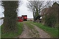
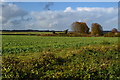
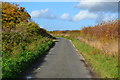
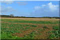
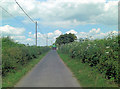
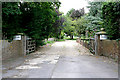
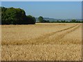
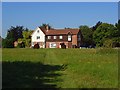
9 photos from this area
Area Information
Key information about the SO20 8JQ including its size, population, and administrative classification.
- Area Type
- Postcode
- Area Size
- 1.4 km²
- Population
- 2065
- Population Density
- 109 people/km²
House Prices in SO20 8JQ
21
Properties
£702,893
Average Sold Price
£205,000
Lowest Price
£1,564,000
Highest Price
Showing 21 properties
| Address | Type | Beds | Baths | Last Sale Price | Last Sale Date | |
|---|---|---|---|---|---|---|
| Wolsten, King Lane, Over Wallop, SO20 8JQ | Detached | 4 | 2 | £843,500 | Nov 2024 | |
| Kingfield House, King Lane, Over Wallop, SO20 8JQ | Land | - | - | £673,750 | May 2018 | |
| Fairfield House, King Lane, Over Wallop, SO20 8JQ | Detached | 6 | - | £662,000 | Jun 2013 | |
| Boarfield House, King Lane, Over Wallop, SO20 8JQ | Detached | 5 | 4 | £1,564,000 | Sep 2012 | |
| Lanford House, King Lane, Over Wallop, SO20 8JQ | Land | - | - | £572,000 | Nov 2009 | |
| Clarendon House, King Lane, Over Wallop, SO20 8JQ | Land | - | - | £400,000 | Jul 1999 | |
| Hurst Lodge, King Lane, Over Wallop, SO20 8JQ | house | - | - | £205,000 | Sep 1995 | |
| House At Sunnyside Poultry Farm, King Lane, Over Wallop, SO20 8JQ | Land | - | - | - | - | |
| Shirville, King Lane, Over Wallop, SO20 8JQ | Land | 6 | 6 | - | - | |
| Annexe, Franquette House, King Lane, Over Wallop, SO20 8JQ | Semi-detached | - | - | - | - |
Page 1 of 3
Energy Efficiency in SO20 8JQ
Amenities
Schools
| Rank | School | Type | Entry gender | Ages |
|---|
Explore more schools in this area
Go to Schools tabDemographics
Household Size
Two person
most common
Accommodation Type
Houses
most common
Tenure
54
majority
Ethnic Group
White
most common
Religion
N/A
most common
Household Composition
N/A
most common
Age
47
median
Adults (30-64 years)
most common
Household Deprivation
N/A
with no deprivation
NS-SEC
49
in Lower managerial occupations
Explore more demographic insights in this area
Go to Demographics tabPlanning
Planning Constraints
- Flood RiskPremium
- Ramsar Wetland SitesPremium
- Area of Outstanding Natural BeautyPremium
- Protected Nature ReservePremium
- Protected WoodlandPremium