Area Overview for SO20 8DZ
Photos of SO20 8DZ
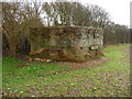
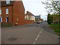
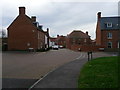
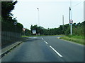
10 photos from this area
Area Information
Key information about the SO20 8DZ including its size, population, and administrative classification.
- Area Type
- Postcode
- Area Size
- 61.8 hectares
- Population
- 2339
- Population Density
- 69 people/km²
House Prices in SO20 8DZ
24
Properties
£307,950
Average Sold Price
£98,500
Lowest Price
£575,000
Highest Price
Showing 24 properties
| Address | Type | Beds | Baths | Last Sale Price | Last Sale Date | |
|---|---|---|---|---|---|---|
| Aberdale, Danebury Road, Kentsboro, Middle Wallop, SO20 8DZ | Semi-detached | 3 | 1 | £415,000 | Mar 2022 | |
| Casa Roma, 4 Danebury Road, Kentsboro, Middle Wallop, SO20 8DZ | Bungalow | 2 | 1 | £380,000 | Dec 2020 | |
| Larch Gables, Old Stockbridge Road, Middle Wallop, SO20 8DZ | house | - | - | £575,000 | Jul 2017 | |
| Thistledown, Danebury Road, Kentsboro, Middle Wallop, SO20 8DZ | Bungalow | - | - | £305,000 | Jul 2015 | |
| 3A Danebury Road, Kentsboro, Middle Wallop, SO20 8DZ | Bungalow | - | - | £323,000 | Nov 2014 | |
| 3B Danebury Road, Kentsboro, Middle Wallop, SO20 8DZ | Bungalow | - | - | £277,000 | Nov 2013 | |
| Whittington, Danebury Road, Kentsboro, Middle Wallop, SO20 8DZ | Semi-detached | 3 | - | £231,000 | Jul 2010 | |
| Fairfield, Danebury Road, Kentsboro, Middle Wallop, SO20 8DZ | Detached | - | - | £265,000 | Dec 2004 | |
| Brambles, Danebury Road, Kentsboro, Middle Wallop, SO20 8DZ | Detached | - | - | £210,000 | Jul 2002 | |
| Hazeldene, Danebury Road, Kentsboro, Middle Wallop, SO20 8DZ | Bungalow | - | - | £98,500 | Dec 1997 |
Page 1 of 3
Energy Efficiency in SO20 8DZ
Amenities
Schools
| Rank | School | Type | Entry gender | Ages |
|---|
Explore more schools in this area
Go to Schools tabDemographics
Household Size
Two person
most common
Accommodation Type
Houses
most common
Tenure
75
majority
Ethnic Group
White
most common
Religion
N/A
most common
Household Composition
N/A
most common
Age
47
median
Adults (30-64 years)
most common
Household Deprivation
N/A
with no deprivation
NS-SEC
41
in Lower managerial occupations
Explore more demographic insights in this area
Go to Demographics tabPlanning
Planning Constraints
- Flood RiskPremium
- Ramsar Wetland SitesPremium
- Area of Outstanding Natural BeautyPremium
- Protected Nature ReservePremium
- Protected WoodlandPremium