Area Overview for SO20 6PW
Photos of SO20 6PW
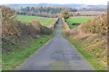
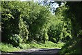
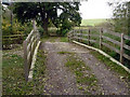
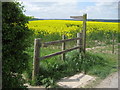
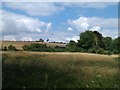
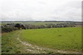
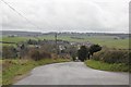
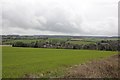
53 photos from this area
Area Information
Key information about the SO20 6PW including its size, population, and administrative classification.
- Area Type
- Postcode
- Area Size
- 16.4 hectares
- Population
- 1207
- Population Density
- 184 people/km²
House Prices in SO20 6PW
18
Properties
£613,071
Average Sold Price
£115,000
Lowest Price
£1,270,000
Highest Price
Showing 18 properties
| Address | Type | Beds | Baths | Last Sale Price | Last Sale Date | |
|---|---|---|---|---|---|---|
| Yew Tree House, Romsey Road, Kings Somborne, SO20 6PW | Semi-detached | 3 | 2 | £800,500 | Aug 2025 | |
| Shappon, Romsey Road, Kings Somborne, SO20 6PW | Detached | 4 | 2 | £800,000 | May 2025 | |
| 6, Crown Cottages, Romsey Road, Kings Somborne, SO20 6PW | house | - | - | £380,000 | Mar 2022 | |
| Willow Cottage, Romsey Road, Kings Somborne, SO20 6PW | Detached | 3 | - | £600,000 | Jun 2021 | |
| Crown Hill Cottage, Romsey Road, Kings Somborne, SO20 6PW | Detached | - | - | £326,000 | Nov 2018 | |
| Rivermead, Froghole Lane, Kings Somborne, SO20 6PW | Detached | - | - | £1,270,000 | Feb 2007 | |
| 7, Crown Cottages, Romsey Road, Kings Somborne, SO20 6PW | Semi-detached | 3 | 1 | £115,000 | Jul 1998 | |
| Fromans House, Romsey Road, Kings Somborne, SO20 6PW | Cottage | 3 | - | - | - | |
| 5, Crown Cottages, Romsey Road, Kings Somborne, SO20 6PW | Semi-detached | - | - | - | - | |
| The Annexe, Crown Hill House, Romsey Road, Kings Somborne, SO20 6PW | undefined | - | - | - | - |
Page 1 of 2
Energy Efficiency in SO20 6PW
Amenities
Schools
| Rank | School | Type | Entry gender | Ages |
|---|
Explore more schools in this area
Go to Schools tabDemographics
Household Size
Two person
most common
Accommodation Type
Houses
most common
Tenure
69
majority
Ethnic Group
White
most common
Religion
N/A
most common
Household Composition
N/A
most common
Age
47
median
Adults (30-64 years)
most common
Household Deprivation
N/A
with no deprivation
NS-SEC
46
in Lower managerial occupations
Explore more demographic insights in this area
Go to Demographics tabPlanning
Planning Constraints
- Flood RiskPremium
- Ramsar Wetland SitesPremium
- Area of Outstanding Natural BeautyPremium
- Protected Nature ReservePremium
- Protected WoodlandPremium