Area Overview for SO20 6NL
Photos of SO20 6NL
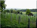
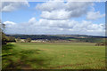
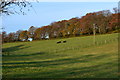
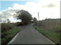
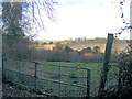
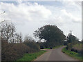
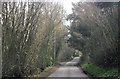
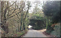
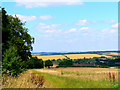
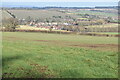
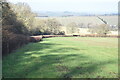
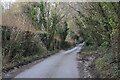
14 photos from this area
Area Information
Key information about the SO20 6NL including its size, population, and administrative classification.
- Area Type
- Postcode
- Area Size
- 79.5 hectares
- Population
- 1207
- Population Density
- 184 people/km²
House Prices in SO20 6NL
23
Properties
£531,667
Average Sold Price
£50,000
Lowest Price
£1,105,000
Highest Price
Showing 23 properties
| Address | Type | Beds | Baths | Last Sale Price | Last Sale Date | |
|---|---|---|---|---|---|---|
| Rosecroft, Furzedown Road, Kings Somborne, SO20 6NL | Detached | 4 | 3 | £1,105,000 | Mar 2025 | |
| The Old Stables, Furzedown Road, Kings Somborne, SO20 6NL | Flat | - | - | £50,000 | Jun 2022 | |
| Walnut Tree Lodge, Furzedown Road, Kings Somborne, SO20 6NL | Detached | 3 | 3 | £685,000 | Jan 2021 | |
| The Herra, Furzedown Road, Kings Somborne, SO20 6NL | Detached | 4 | 3 | £740,000 | Jul 2020 | |
| The Swallows, Furzedown Road, Kings Somborne, SO20 6NL | Flat | - | - | £50,000 | Oct 2019 | |
| Furzedown Farm, Furzedown Road, Kings Somborne, SO20 6NL | Detached | 4 | - | £645,000 | Jan 2017 | |
| Oakfields, Furzedown Road, Kings Somborne, SO20 6NL | house | - | - | £940,000 | Nov 2015 | |
| Hillcrest, Furzedown Road, Kings Somborne, SO20 6NL | house | 3 | - | £370,000 | Jun 2011 | |
| The Bothy, Furzedown Road, Kings Somborne, SO20 6NL | Detached | 4 | - | £200,000 | Jul 2000 | |
| 1, Old Barn Studio, Furzedown Road, Kings Somborne, SO20 6NL | Flat | 1 | 1 | - | - |
Page 1 of 3
Energy Efficiency in SO20 6NL
Amenities
Schools
| Rank | School | Type | Entry gender | Ages |
|---|
Explore more schools in this area
Go to Schools tabDemographics
Household Size
Two person
most common
Accommodation Type
Houses
most common
Tenure
69
majority
Ethnic Group
White
most common
Religion
N/A
most common
Household Composition
N/A
most common
Age
47
median
Adults (30-64 years)
most common
Household Deprivation
N/A
with no deprivation
NS-SEC
46
in Lower managerial occupations
Explore more demographic insights in this area
Go to Demographics tabPlanning
Planning Constraints
- Flood RiskPremium
- Ramsar Wetland SitesPremium
- Area of Outstanding Natural BeautyPremium
- Protected Nature ReservePremium
- Protected WoodlandPremium