Area Overview for SO20 6DR
Photos of SO20 6DR
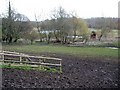
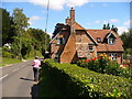
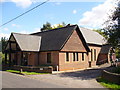
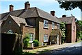
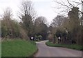
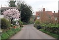
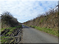
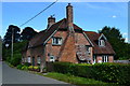
14 photos from this area
Area Information
Key information about the SO20 6DR including its size, population, and administrative classification.
- Area Type
- Postcode
- Area Size
- 8.4 hectares
- Population
- 1556
- Population Density
- 37 people/km²
House Prices in SO20 6DR
17
Properties
£777,139
Average Sold Price
£325,000
Lowest Price
£1,550,000
Highest Price
Showing 17 properties
| Address | Type | Beds | Baths | Last Sale Price | Last Sale Date | |
|---|---|---|---|---|---|---|
| Old School House, Longstock Road, Longstock, SO20 6DR | house | 4 | - | £1,030,000 | Jul 2024 | |
| 29 Longstock Road, Longstock, SO20 6DR | house | - | - | £690,000 | Jul 2023 | |
| 31 Longstock Road, Longstock, SO20 6DR | Semi-detached | 5 | 2 | £371,250 | Mar 2020 | |
| Upper Manor Farm, Longstock Road, Longstock, SO20 6DR | Farm | 6 | 2 | £1,550,000 | Jun 2017 | |
| Sindle Cottage, 18 Longstock Road, Longstock, SO20 6DR | house | - | - | £685,000 | Dec 2016 | |
| Long House, Longstock Road, Longstock, SO20 6DR | Detached | 3 | 2 | £875,000 | Nov 2015 | |
| Barn Cottage, Longstock Road, Longstock, SO20 6DR | Detached | - | - | £950,000 | Feb 2014 | |
| Old Thatch, Longstock Road, Longstock, SO20 6DR | house | 3 | - | £518,000 | Jun 2012 | |
| Cappella, Longstock Road, Longstock, SO20 6DR | house | - | - | £325,000 | Oct 2009 | |
| Old Post Office, Longstock Road, Longstock, SO20 6DR | Detached | 2 | 1 | - | - |
Page 1 of 2
Energy Efficiency in SO20 6DR
Amenities
Schools
| Rank | School | Type | Entry gender | Ages |
|---|
Explore more schools in this area
Go to Schools tabDemographics
Household Size
Two person
most common
Accommodation Type
Houses
most common
Tenure
69
majority
Ethnic Group
White
most common
Religion
N/A
most common
Household Composition
N/A
most common
Age
47
median
Adults (30-64 years)
most common
Household Deprivation
N/A
with no deprivation
NS-SEC
44
in Lower managerial occupations
Explore more demographic insights in this area
Go to Demographics tabPlanning
Planning Constraints
- Flood RiskPremium
- Ramsar Wetland SitesPremium
- Area of Outstanding Natural BeautyPremium
- Protected Nature ReservePremium
- Protected WoodlandPremium