Area Overview for SO19 9LA
Photos of SO19 9LA
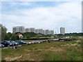

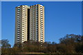
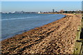
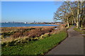
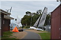
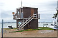
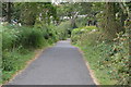
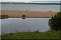
93 photos from this area
Area Information
Key information about the SO19 9LA including its size, population, and administrative classification.
- Area Type
- Postcode
- Area Size
- 6.0 hectares
- Population
- 1689
- Population Density
- 8028 people/km²
House Prices in SO19 9LA
90
Properties
£174,000
Average Sold Price
£46,500
Lowest Price
£310,000
Highest Price
Showing 90 properties
| Address | Type | Beds | Baths | Last Sale Price | Last Sale Date | |
|---|---|---|---|---|---|---|
| 120 Kingsclere Avenue, Southampton, SO19 9LA | Maisonette | 1 | 1 | £108,000 | Aug 2025 | |
| 8 Kingsclere Avenue, Southampton, SO19 9LA | Terraced | 3 | 2 | £290,000 | Aug 2025 | |
| 128 Kingsclere Avenue, Southampton, SO19 9LA | Maisonette | 1 | - | £125,000 | Mar 2025 | |
| 12A Kingsclere Avenue, Southampton, SO19 9LA | Terraced | 3 | 1 | £310,000 | Apr 2024 | |
| 34 Kingsclere Avenue, Southampton, SO19 9LA | Terraced | 3 | - | £235,000 | Mar 2021 | |
| 2 Kingsclere Avenue, Southampton, SO19 9LA | Terraced | 3 | 2 | £247,500 | Jan 2021 | |
| 10A Kingsclere Avenue, Southampton, SO19 9LA | Terraced | 2 | 1 | £216,000 | Nov 2019 | |
| 18 Kingsclere Avenue, Southampton, SO19 9LA | Terraced | 3 | 3 | £225,000 | Jul 2018 | |
| 32 Kingsclere Avenue, Southampton, SO19 9LA | house | 3 | - | £148,000 | Jun 2016 | |
| 14 Kingsclere Avenue, Southampton, SO19 9LA | Terraced | 3 | 2 | £195,000 | Jun 2016 |
Page 1 of 9
Energy Efficiency in SO19 9LA
Amenities
Schools
| Rank | School | Type | Entry gender | Ages |
|---|
Explore more schools in this area
Go to Schools tabDemographics
Household Size
One person
most common
Accommodation Type
Houses
most common
Tenure
35
majority
Ethnic Group
White
most common
Religion
N/A
most common
Household Composition
N/A
most common
Age
47
median
Adults (30-64 years)
most common
Household Deprivation
N/A
with no deprivation
NS-SEC
19
in Lower managerial occupations
Explore more demographic insights in this area
Go to Demographics tabPlanning
Planning Constraints
- Flood RiskPremium
- Area of Outstanding Natural BeautyPremium
- Protected Nature ReservePremium
- Protected WoodlandPremium