Area Overview for SO19 9BR
Photos of SO19 9BR
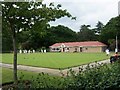
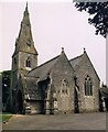
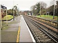
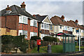
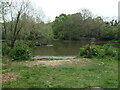
69 photos from this area
Area Information
Key information about the SO19 9BR including its size, population, and administrative classification.
- Area Type
- Postcode
- Area Size
- 1.1 hectares
- Population
- 1883
- Population Density
- 6897 people/km²
House Prices in SO19 9BR
42
Properties
£263,150
Average Sold Price
£70,000
Lowest Price
£388,000
Highest Price
Showing 42 properties
| Address | Type | Beds | Baths | Last Sale Price | Last Sale Date | |
|---|---|---|---|---|---|---|
| 30 Oak Road, Southampton, SO19 9BR | Terraced | 2 | 1 | £220,500 | Jan 2024 | |
| 32 Oak Road, Southampton, SO19 9BR | house | 2 | 1 | £250,000 | Sep 2023 | |
| Alston Villa, 50 Oak Road, Southampton, SO19 9BR | Semi-detached | 3 | 2 | £385,000 | Mar 2021 | |
| 44 Oak Road, Southampton, SO19 9BR | Semi-detached | 3 | 1 | £380,000 | Oct 2020 | |
| 8 Oak Road, Southampton, SO19 9BR | Detached | 4 | - | £388,000 | May 2015 | |
| 42 Oak Road, Southampton, SO19 9BR | Detached | 4 | - | £342,000 | Jul 2014 | |
| 28 Oak Road, Southampton, SO19 9BR | house | - | - | £141,000 | Oct 2009 | |
| 6 Oak Road, Southampton, SO19 9BR | Detached | - | - | £360,000 | Jul 2008 | |
| 22 Oak Road, Southampton, SO19 9BR | Terraced | 2 | - | £95,000 | Sep 2002 | |
| Lilacs, 14 Oak Road, Southampton, SO19 9BR | Semi-detached | 3 | 1 | £70,000 | Jan 1997 |
Page 1 of 5
Energy Efficiency in SO19 9BR
Amenities
Schools
| Rank | School | Type | Entry gender | Ages |
|---|
Explore more schools in this area
Go to Schools tabDemographics
Household Size
One person
most common
Accommodation Type
Houses
most common
Tenure
47
majority
Ethnic Group
White
most common
Religion
N/A
most common
Household Composition
N/A
most common
Age
47
median
Adults (30-64 years)
most common
Household Deprivation
N/A
with no deprivation
NS-SEC
32
in Lower managerial occupations
Explore more demographic insights in this area
Go to Demographics tabPlanning
Planning Constraints
- Flood RiskPremium
- Ramsar Wetland SitesPremium
- Area of Outstanding Natural BeautyPremium
- Protected Nature ReservePremium
- Protected WoodlandPremium