Area Overview for SO19 9BE
Photos of SO19 9BE


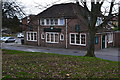
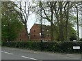
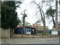
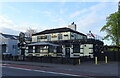

66 photos from this area
Area Information
Key information about the SO19 9BE including its size, population, and administrative classification.
- Area Type
- Postcode
- Area Size
- 2.0 hectares
- Population
- 1538
- Population Density
- 76429 people/km²
House Prices in SO19 9BE
43
Properties
£435,804
Average Sold Price
£84,000
Lowest Price
£1,774,763
Highest Price
Showing 43 properties
| Address | Type | Beds | Baths | Last Sale Price | Last Sale Date | |
|---|---|---|---|---|---|---|
| 87 Portsmouth Road, Southampton, SO19 9BE | Semi-detached | 4 | 3 | £390,000 | Sep 2025 | |
| 111 Portsmouth Road, Southampton, SO19 9BE | Detached | 3 | 2 | £415,000 | Mar 2024 | |
| 89 Portsmouth Road, Southampton, SO19 9BE | Semi-detached | 4 | - | £355,000 | Jan 2021 | |
| South Haven Lodge Rest Home, 69-73 Portsmouth Road, Southampton, SO19 9BE | hospital_care_home | - | - | £1,774,763 | May 2019 | |
| 77 Portsmouth Road, Southampton, SO19 9BE | Semi-detached | 4 | 3 | £410,000 | Jan 2019 | |
| 67 Portsmouth Road, Southampton, SO19 9BE | Detached | - | - | £180,000 | Oct 2018 | |
| Beechwood Care Home, 65 Portsmouth Road, Southampton, SO19 9BE | Detached | 17 | - | £450,000 | Jul 2018 | |
| 99 Portsmouth Road, Southampton, SO19 9BE | hospital_care_home | - | - | £1,253,308 | Jun 2017 | |
| 61 Portsmouth Road, Southampton, SO19 9BE | house | - | - | £450,000 | Jun 2015 | |
| 93 Portsmouth Road, Southampton, SO19 9BE | Semi-detached | 4 | - | £300,000 | Dec 2013 |
Page 1 of 5
Energy Efficiency in SO19 9BE
Amenities
Schools
| Rank | School | Type | Entry gender | Ages |
|---|
Explore more schools in this area
Go to Schools tabDemographics
Household Size
One person
most common
Accommodation Type
Houses
most common
Tenure
70
majority
Ethnic Group
White
most common
Religion
N/A
most common
Household Composition
N/A
most common
Age
47
median
Adults (30-64 years)
most common
Household Deprivation
N/A
with no deprivation
NS-SEC
38
in Lower managerial occupations
Explore more demographic insights in this area
Go to Demographics tabPlanning
Planning Constraints
- Flood RiskPremium
- Ramsar Wetland SitesPremium
- Area of Outstanding Natural BeautyPremium
- Protected Nature ReservePremium
- Protected WoodlandPremium