Area Overview for SO19 9AX
Photos of SO19 9AX
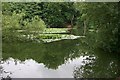
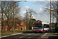
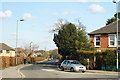
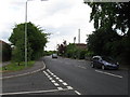
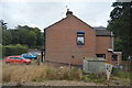
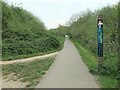
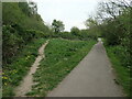
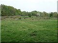
28 photos from this area
Area Information
Key information about the SO19 9AX including its size, population, and administrative classification.
- Area Type
- Postcode
- Area Size
- 2.1 hectares
- Population
- 1501
- Population Density
- 5289 people/km²
House Prices in SO19 9AX
43
Properties
£117,527
Average Sold Price
£36,950
Lowest Price
£238,000
Highest Price
Showing 43 properties
| Address | Type | Beds | Baths | Last Sale Price | Last Sale Date | |
|---|---|---|---|---|---|---|
| 81 Hawkhurst Close, Southampton, SO19 9AX | Maisonette | 2 | 1 | £138,000 | May 2023 | |
| 43 Hawkhurst Close, Southampton, SO19 9AX | Terraced | 3 | 1 | £238,000 | Mar 2023 | |
| 50 Hawkhurst Close, Southampton, SO19 9AX | house | - | - | £217,000 | Mar 2021 | |
| 47 Hawkhurst Close, Southampton, SO19 9AX | Terraced | 3 | 1 | £215,000 | Feb 2020 | |
| 78 Hawkhurst Close, Southampton, SO19 9AX | Maisonette | 2 | 1 | £132,000 | Apr 2019 | |
| 44 Hawkhurst Close, Southampton, SO19 9AX | Terraced | 3 | 1 | £215,000 | Dec 2018 | |
| 68 Hawkhurst Close, Southampton, SO19 9AX | Maisonette | 2 | 1 | £140,000 | Sep 2018 | |
| 76 Hawkhurst Close, Southampton, SO19 9AX | Flat | - | - | £143,000 | Aug 2018 | |
| 48 Hawkhurst Close, Southampton, SO19 9AX | Terraced | 3 | 1 | £210,000 | Oct 2017 | |
| 51 Hawkhurst Close, Southampton, SO19 9AX | house | - | - | £179,950 | Oct 2016 |
Page 1 of 5
Energy Efficiency in SO19 9AX
Amenities
Schools
| Rank | School | Type | Entry gender | Ages |
|---|
Explore more schools in this area
Go to Schools tabDemographics
Household Size
Family (3-5 people)
most common
Accommodation Type
Houses
most common
Tenure
70
majority
Ethnic Group
White
most common
Religion
N/A
most common
Household Composition
N/A
most common
Age
47
median
Adults (30-64 years)
most common
Household Deprivation
N/A
with no deprivation
NS-SEC
26
in Lower managerial occupations
Explore more demographic insights in this area
Go to Demographics tabPlanning
Planning Constraints
- Flood RiskPremium
- Ramsar Wetland SitesPremium
- Area of Outstanding Natural BeautyPremium
- Protected Nature ReservePremium
- Protected WoodlandPremium