Area Overview for SO19 9AQ
Photos of SO19 9AQ
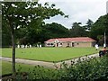
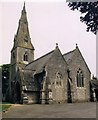

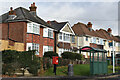
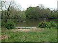
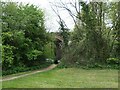
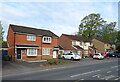
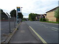
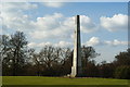
69 photos from this area
Area Information
Key information about the SO19 9AQ including its size, population, and administrative classification.
- Area Type
- Postcode
- Area Size
- 8266 m²
- Population
- 1700
- Population Density
- 3200 people/km²
House Prices in SO19 9AQ
15
Properties
£166,360
Average Sold Price
£51,000
Lowest Price
£268,000
Highest Price
Showing 15 properties
| Address | Type | Beds | Baths | Last Sale Price | Last Sale Date | |
|---|---|---|---|---|---|---|
| 158 Portsmouth Road, Southampton, SO19 9AQ | Semi-detached | 2 | 1 | £239,800 | Sep 2024 | |
| 154 Portsmouth Road, Southampton, SO19 9AQ | Semi-detached | 3 | 2 | £268,000 | Oct 2023 | |
| 174 Portsmouth Road, Southampton, SO19 9AQ | Semi-detached | 3 | - | £215,000 | Aug 2016 | |
| 152 Portsmouth Road, Southampton, SO19 9AQ | Semi-detached | 2 | 1 | £51,000 | May 2000 | |
| 176 Portsmouth Road, Southampton, SO19 9AQ | house | - | - | £58,000 | Apr 2000 | |
| Global Fuel Uk Limited, Rear Of 170, Portsmouth Road, Southampton, SO19 9AQ | Industrial | - | - | - | - | |
| 160 Portsmouth Road, Southampton, SO19 9AQ | Semi-detached | - | - | - | - | |
| 162 Portsmouth Road, Southampton, SO19 9AQ | Semi-detached | - | - | - | - | |
| 156 Portsmouth Road, Southampton, SO19 9AQ | house | 3 | - | - | - | |
| 150 Portsmouth Road, Southampton, SO19 9AQ | Detached | - | - | - | - |
Page 1 of 2
Energy Efficiency in SO19 9AQ
Amenities
Schools
| Rank | School | Type | Entry gender | Ages |
|---|
Explore more schools in this area
Go to Schools tabDemographics
Household Size
Two person
most common
Accommodation Type
Houses
most common
Tenure
68
majority
Ethnic Group
White
most common
Religion
N/A
most common
Household Composition
N/A
most common
Age
47
median
Adults (30-64 years)
most common
Household Deprivation
N/A
with no deprivation
NS-SEC
31
in Lower managerial occupations
Explore more demographic insights in this area
Go to Demographics tabPlanning
Planning Constraints
- Flood RiskPremium
- Ramsar Wetland SitesPremium
- Area of Outstanding Natural BeautyPremium
- Protected Nature ReservePremium