Area Overview for SO19 7NH
Photos of SO19 7NH
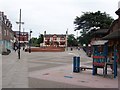
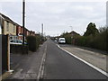
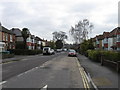
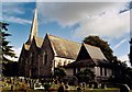
40 photos from this area
Area Information
Key information about the SO19 7NH including its size, population, and administrative classification.
- Area Type
- Postcode
- Area Size
- 3858 m²
- Population
- 2086
- Population Density
- 4775 people/km²
House Prices in SO19 7NH
11
Properties
£161,373
Average Sold Price
£52,500
Lowest Price
£290,000
Highest Price
Showing 11 properties
| Address | Type | Beds | Baths | Last Sale Price | Last Sale Date | |
|---|---|---|---|---|---|---|
| 56 Bursledon Road, Southampton, SO19 7NH | Semi-detached | 3 | 1 | £290,000 | Feb 2024 | |
| 60 Bursledon Road, Southampton, SO19 7NH | Semi-detached | 3 | - | £210,000 | Oct 2015 | |
| 62 Bursledon Road, Southampton, SO19 7NH | house | - | - | £165,000 | Mar 2012 | |
| 42 Bursledon Road, Southampton, SO19 7NH | house | 3 | - | £219,410 | Nov 2009 | |
| 52 Bursledon Road, Southampton, SO19 7NH | Semi-detached | 3 | 2 | £147,000 | May 2006 | |
| 58 Bursledon Road, Southampton, SO19 7NH | Semi-detached | - | - | £165,000 | Aug 2004 | |
| 44 Bursledon Road, Southampton, SO19 7NH | Detached | - | - | £118,500 | Mar 2000 | |
| 54 Bursledon Road, Southampton, SO19 7NH | Detached | - | - | £84,950 | Jan 2000 | |
| 46 Bursledon Road, Southampton, SO19 7NH | Semi-detached | - | - | £52,500 | Dec 1997 | |
| 50 Bursledon Road, Southampton, SO19 7NH | house | - | - | - | - |
Page 1 of 2
Energy Efficiency in SO19 7NH
Amenities
Schools
| Rank | School | Type | Entry gender | Ages |
|---|
Explore more schools in this area
Go to Schools tabDemographics
Household Size
Two person
most common
Accommodation Type
Houses
most common
Tenure
82
majority
Ethnic Group
White
most common
Religion
N/A
most common
Household Composition
N/A
most common
Age
47
median
Adults (30-64 years)
most common
Household Deprivation
N/A
with no deprivation
NS-SEC
33
in Lower managerial occupations
Explore more demographic insights in this area
Go to Demographics tabPlanning
Planning Constraints
- Flood RiskPremium
- Ramsar Wetland SitesPremium
- Area of Outstanding Natural BeautyPremium
- Protected Nature ReservePremium
- Protected WoodlandPremium