Area Overview for SO19 4DU
Photos of SO19 4DU
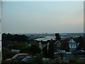
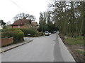
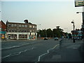
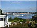
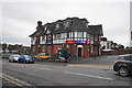

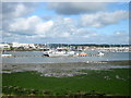


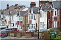

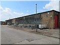
40 photos from this area
Area Information
Key information about the SO19 4DU including its size, population, and administrative classification.
- Area Type
- Postcode
- Area Size
- 8176 m²
- Population
- 1368
- Population Density
- 4298 people/km²
House Prices in SO19 4DU
19
Properties
£230,652
Average Sold Price
£73,500
Lowest Price
£425,000
Highest Price
Showing 19 properties
| Address | Type | Beds | Baths | Last Sale Price | Last Sale Date | |
|---|---|---|---|---|---|---|
| 35 Little Lances Hill, Southampton, SO19 4DU | house | - | - | £365,000 | Jul 2021 | |
| 7 Little Lances Hill, Southampton, SO19 4DU | Semi-detached | 3 | 2 | £295,000 | Jul 2020 | |
| 17 Little Lances Hill, Southampton, SO19 4DU | Detached | 4 | 3 | £425,000 | Apr 2019 | |
| 9 Little Lances Hill, Southampton, SO19 4DU | Semi-detached | 3 | 1 | £261,500 | Aug 2018 | |
| 29 Little Lances Hill, Southampton, SO19 4DU | Semi-detached | 5 | - | £249,950 | Jun 2014 | |
| 11 Little Lances Hill, Southampton, SO19 4DU | Detached | 2 | 1 | £223,267 | Jun 2014 | |
| 3 Little Lances Hill, Southampton, SO19 4DU | Flat | 1 | 1 | £208,000 | Dec 2007 | |
| 15 Little Lances Hill, Southampton, SO19 4DU | Detached | - | - | £249,000 | Aug 2007 | |
| 13 Little Lances Hill, Southampton, SO19 4DU | Detached | - | - | £103,950 | Jun 1999 | |
| 27 Little Lances Hill, Southampton, SO19 4DU | Semi-detached | - | - | £83,000 | Nov 1998 |
Page 1 of 2
Energy Efficiency in SO19 4DU
Amenities
Schools
| Rank | School | Type | Entry gender | Ages |
|---|
Explore more schools in this area
Go to Schools tabDemographics
Household Size
Family (3-5 people)
most common
Accommodation Type
Houses
most common
Tenure
78
majority
Ethnic Group
White
most common
Religion
N/A
most common
Household Composition
N/A
most common
Age
47
median
Adults (30-64 years)
most common
Household Deprivation
N/A
with no deprivation
NS-SEC
38
in Lower managerial occupations
Explore more demographic insights in this area
Go to Demographics tabPlanning
Planning Constraints
- Flood RiskPremium
- Ramsar Wetland SitesPremium
- Area of Outstanding Natural BeautyPremium
- Protected Nature ReservePremium
- Protected WoodlandPremium