Area Overview for SO19 2PG
Photos of SO19 2PG
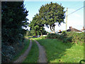

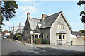
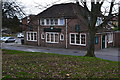
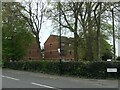
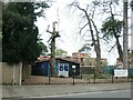
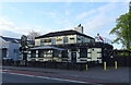
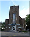
66 photos from this area
Area Information
Key information about the SO19 2PG including its size, population, and administrative classification.
- Area Type
- Postcode
- Area Size
- 3767 m²
- Population
- 1805
- Population Density
- 7235 people/km²
House Prices in SO19 2PG
15
Properties
£230,654
Average Sold Price
£122,000
Lowest Price
£310,000
Highest Price
Showing 15 properties
| Address | Type | Beds | Baths | Last Sale Price | Last Sale Date | |
|---|---|---|---|---|---|---|
| 4 Pinegrove Road, Southampton, SO19 2PG | Semi-detached | 3 | 1 | £275,000 | Oct 2023 | |
| 16 Pinegrove Road, Southampton, SO19 2PG | Semi-detached | 2 | 1 | £310,000 | Aug 2023 | |
| 26 Pinegrove Road, Southampton, SO19 2PG | house | - | - | £285,000 | Jun 2023 | |
| 24 Pinegrove Road, Southampton, SO19 2PG | Semi-detached | 3 | 2 | £274,000 | Sep 2021 | |
| 6 Pinegrove Road, Southampton, SO19 2PG | Semi-detached | 3 | 1 | £255,000 | Aug 2018 | |
| 22 Pinegrove Road, Southampton, SO19 2PG | Semi-detached | 3 | - | £215,000 | Oct 2017 | |
| 14 Pinegrove Road, Southampton, SO19 2PG | Semi-detached | 2 | - | £180,000 | May 2017 | |
| 12 Pinegrove Road, Southampton, SO19 2PG | Semi-detached | 3 | - | £240,000 | Jan 2017 | |
| 20 Pinegrove Road, Southampton, SO19 2PG | Semi-detached | 3 | - | £180,000 | Jun 2014 | |
| 28 Pinegrove Road, Southampton, SO19 2PG | house | - | - | £173,000 | May 2008 |
Page 1 of 2
Energy Efficiency in SO19 2PG
Amenities
Schools
| Rank | School | Type | Entry gender | Ages |
|---|
Explore more schools in this area
Go to Schools tabDemographics
Household Size
One person
most common
Accommodation Type
Houses
most common
Tenure
51
majority
Ethnic Group
White
most common
Religion
N/A
most common
Household Composition
N/A
most common
Age
47
median
Adults (30-64 years)
most common
Household Deprivation
N/A
with no deprivation
NS-SEC
28
in Lower managerial occupations
Explore more demographic insights in this area
Go to Demographics tabPlanning
Planning Constraints
- Flood RiskPremium
- Ramsar Wetland SitesPremium
- Area of Outstanding Natural BeautyPremium
- Protected Nature ReservePremium
- Protected WoodlandPremium